Cieneguilla geodata
Cieneguilla (Oaxaca) is a populated place; located in Mexico in America/Mexico_City (GMT-6) time zone. With population of 1,330 people, there are 6531 cities with bigger population in this country. Compared to other cities in Mexico, 95.5% of cities are located further ↑North; 71.4% of cities are located further ←West and 56% of cities have lower elevation than Cieneguilla. Note1


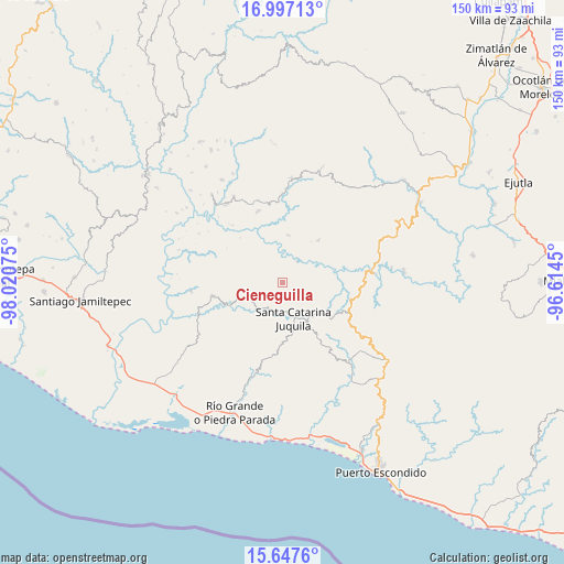
Cieneguilla GPS coordinates[2]
16° 19' 24.708" North, 97° 19' 3.432" West
| Map corner | latitude | longitude |
|---|---|---|
| Upper-left | 16.99713°, | -98.02075° |
| Center: | 16.32353°, | -97.31762° |
| Lower-right: | 15.6476°, | -96.6145° |
| Map W x H: | 150.1×150.1 km | = 93.3×93.3mi |
| max Lat: | 32.7° ⇑95.5% North |
| Cieneguilla: | 16.32353° |
| min Lat: | ⇓4.5% South 14.53588° |
| min Long | Cieneguilla | max Long |
| -117.105° | -97.31762° | -86.73105° |
| W 71.4%⇐ | ⇒28.6% E |
Elevation
Elevation of Cieneguilla is 1620 m = 5315 ft, and this is 366.3 m = 1202 ft above average elevation for this country.
| Max E: |
3497 m = 11473 ft | 44% |
| Cieneguilla | 1620 m 5315 ft | |
| Avg. | 1253.7 m = 4113 ft | |
Min E: |
-1 m = -3 ft | 56% |
See also: Mexico elevation on elevation.city.
Geographical zone
Cieneguilla is located in North Torrid zone (between Equator and Tropic of Cancer). Distance of this Northern Tropic circle is 790.9 km =491.4 mi to North.| Distance of | km | miles | from Cieneguilla |
|---|---|---|---|
| North Pole | 8192.1 | 5090.3 | to North |
| Arctic Circle | 5586.2 | 3471.1 | to North |
| Tropic Cancer | 790.9 | 491.4 | to North |
| Equator | 1815 | 1127.8 | to South |


Nearby cities:
15 places around Cieneguilla: (largest is in red/bold)
• Ampliación Barrio Grande y la Asunción
10.3 km =6.4 mi,  166°
166°
• Cuajinicuil
20.3 km =12.6 mi,  340°
340°
• El Portillo
24 km =14.9 mi,  334°
334°
• La Conchita
20.9 km =13 mi,  317°
317°
• Peñas Negras
21.3 km =13.2 mi,  239°
239°
• San Francisco Ixpantepec
8.8 km =5.5 mi,  120°
120°
• San Jacinto Tlacotepec
23.1 km =14.4 mi, 341°
• San Juan Quiahue
2.4 km =1.5 mi,  179°
179°
• San Marcos Zacatepec
20.5 km =12.7 mi,  191°
191°
• San Miguel Panixtlahuaca
9.5 km =5.9 mi,  221°
221°
• Santa Catarina Juquila
9.9 km =6.2 mi,  163°
163°
• Santa Lucía Teotepec
23.2 km =14.4 mi,  149°
149°
• Santa María Temaxcaltepec
21.8 km =13.5 mi,  143°
143°
• Santiago Yaitepec
12 km =7.5 mi, 154°
• Tepenixtlahuaca
18.9 km =11.7 mi,  259°
259°
Sources, notices
• [Note1] Compared only with cities in Mexico existing in our database
• [Src1] Map data: © OpenStreetMap contributors (CC-BY-SA)
• [Src2] Other city data from geonames.org with taken over terms of usage.
• [Src3] Geographical zone / Annual Mean Temperature by Robert A. Rohde @ Wikipedia
