San Jacinto Tlacotepec geodata
San Jacinto Tlacotepec (Oaxaca) is a populated place; located in Mexico in America/Mexico_City (GMT-6) time zone. With population of 630 people, there are 13737 cities with bigger population in this country. Compared to other cities in Mexico, 94.2% of cities are located further ↑North; 70.7% of cities are located further ←West and 58.3% of cities have higher elevation than San Jacinto Tlacotepec. Note1
Current local time in San Jacinto Tlacotepec:
08:26 AM, WednesdayDifference from your time zone: hours


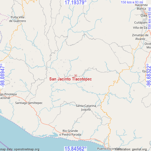
San Jacinto Tlacotepec GPS coordinates[2]
16° 31' 15.168" North, 97° 23' 10.824" West
| Map corner | latitude | longitude |
|---|---|---|
| Upper-left | 17.19379°, | -98.08947° |
| Center: | 16.52088°, | -97.38634° |
| Lower-right: | 15.84562°, | -96.68322° |
| Map W x H: | 149.9×149.9 km | = 93.1×93.1mi |
| max Lat: | 32.7° ⇑94.2% North |
| San Jacinto Tlacotepec: | 16.52088° |
| min Lat: | ⇓5.8% South 14.53588° |
| min Long | San Jacinto Tla | max Long |
| -117.105° | -97.38634° | -86.73105° |
| W 70.7%⇐ | ⇒29.3% E |
Elevation
Elevation of San Jacinto Tlacotepec is 1090 m = 3576 ft, and this is 163.7 m = 537 ft below average elevation for this country.
| Max E: |
3497 m = 11473 ft | 58.3% |
| Avg. | 1253.7 m = 4113 ft | |
| San Jacinto Tlacotepec | 1090 m = 3576 ft | |
Min E: |
-1 m = -3 ft | 41.7% |
See also: Mexico elevation on elevation.city.
Geographical zone
San Jacinto Tlacotepec is located in North Torrid zone (between Equator and Tropic of Cancer). Distance of this Northern Tropic circle is 769 km =477.8 mi to North.| Distance of | km | miles | from San Jacinto Tlacotepec |
|---|---|---|---|
| North Pole | 8170.1 | 5076.7 | to North |
| Arctic Circle | 5564.2 | 3457.4 | to North |
| Tropic Cancer | 769 | 477.8 | to North |
| Equator | 1836.9 | 1141.4 | to South |


Nearby cities:
15 places around San Jacinto Tlacotepec: (largest is in red/bold)
• Colonia de Jesús (La Cucaracha)
16.9 km =10.5 mi,  323°
323°
• Cuajinicuil
2.9 km =1.8 mi,  165°
165°
• El Carrizal
6.2 km =3.9 mi,  281°
281°
• El Limoncillo
13.1 km =8.1 mi,  271°
271°
• El Portillo
3.2 km =2 mi,  262°
262°
• La Conchita
9.3 km =5.8 mi,  226°
226°
• Llano Nuevo
15.8 km =9.8 mi,  304°
304°
• Mano del Señor
9.4 km =5.8 mi, 319°
• Piedra Grande
16.7 km =10.4 mi,  286°
286°
• Quinicuena
14.7 km =9.1 mi, 274°
• San José
7.7 km =4.8 mi, 260°
• San Pedro del Río
10.2 km =6.3 mi, 263°
• Santa Cruz Zenzontepec
11.7 km =7.3 mi, 277°
• Santa María Zaniza
15.8 km =9.8 mi,  19°
19°
• Santiago Amoltepec
17.9 km =11.1 mi, 319°
Sources, notices
• [Note1] Compared only with cities in Mexico existing in our database
• [Src1] Map data: © OpenStreetMap contributors (CC-BY-SA)
• [Src2] Other city data from geonames.org with taken over terms of usage.
• [Src3] Geographical zone / Annual Mean Temperature by Robert A. Rohde @ Wikipedia
