Cerro Gordo geodata
Cerro Gordo (Querétaro) is a populated place; located in Mexico in America/Mexico_City (GMT-6) time zone. With population of 1,987 people, there are 4386 cities with bigger population in this country. Compared to other cities in Mexico, 65% of cities are located further ↓South; 62.8% of cities are located further →East and 75.9% of cities have lower elevation than Cerro Gordo. Note1


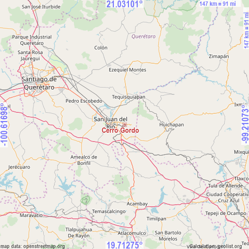
Cerro Gordo GPS coordinates[2]
20° 22' 23.844" North, 99° 54' 49.86" West
| Map corner | latitude | longitude |
|---|---|---|
| Upper-left | 21.03101°, | -100.61698° |
| Center: | 20.37329°, | -99.91385° |
| Lower-right: | 19.71275°, | -99.21073° |
| Map W x H: | 146.6×146.6 km | = 91.1×91.1mi |
| max Lat: | 32.7° ⇑35% North |
| Cerro Gordo: | 20.37329° |
| min Lat: | ⇓65% South 14.53588° |
| min Long | Cerro Gordo | max Long |
| -117.105° | -99.91385° | -86.73105° |
| W 37.2%⇐ | ⇒62.8% E |
Elevation
Elevation of Cerro Gordo is 2046 m = 6713 ft, and this is 792.3 m = 2599 ft above average elevation for this country.
| Max E: |
3497 m = 11473 ft | 24.1% |
| Cerro Gordo | 2046 m 6713 ft | |
| Avg. | 1253.7 m = 4113 ft | |
Min E: |
-1 m = -3 ft | 75.9% |
See also: Mexico elevation on elevation.city.
Geographical zone
Cerro Gordo is located in North Torrid zone (between Equator and Tropic of Cancer). Distance of this Northern Tropic circle is 340.6 km =211.6 mi to North.| Distance of | km | miles | from Cerro Gordo |
|---|---|---|---|
| North Pole | 7741.8 | 4810.5 | to North |
| Arctic Circle | 5135.9 | 3191.3 | to North |
| Tropic Cancer | 340.6 | 211.6 | to North |
| Equator | 2265.3 | 1407.6 | to South |


Nearby cities:
15 places around Cerro Gordo: (largest is in red/bold)
• El Cazadero
9.2 km =5.7 mi,  151°
151°
• El Mirador
8.5 km =5.3 mi,  332°
332°
• El Rodeo
7.1 km =4.4 mi,  249°
249°
• El Sitio
6.1 km =3.8 mi,  98°
98°
• Lázaro Cárdenas (1ra. Sección del Rodeo)
7.2 km =4.5 mi,  256°
256°
• Palmillas
5 km =3.1 mi,  213°
213°
• Paso de Mata
3.7 km =2.3 mi,  201°
201°
• Pueblo Quieto
9.8 km =6.1 mi,  324°
324°
• Puerta de Palmillas
6.8 km =4.2 mi,  182°
182°
• San Francisco
5.2 km =3.2 mi,  244°
244°
• San Juan del Río
8.7 km =5.4 mi,  281°
281°
• Santa Bárbara de La Cueva
10 km =6.2 mi, 210°
• Santa Cruz Escandón
6.4 km =4 mi, 317°
• Santa Rosa Xajay
7.2 km =4.5 mi,  12°
12°
• Villas Fundadores [Fraccionamiento]
0.7 km =0.4 mi,  42°
42°
Sources, notices
• [Note1] Compared only with cities in Mexico existing in our database
• [Src1] Map data: © OpenStreetMap contributors (CC-BY-SA)
• [Src2] Other city data from geonames.org with taken over terms of usage.
• [Src3] Geographical zone / Annual Mean Temperature by Robert A. Rohde @ Wikipedia
