El Cazadero geodata
El Cazadero (Querétaro) is a populated place; located in Mexico in America/Mexico_City (GMT-6) time zone. With population of 3,401 people, there are 2673 cities with bigger population in this country. Compared to other cities in Mexico, 63.5% of cities are located further ↓South; 62.3% of cities are located further →East and 84.9% of cities have lower elevation than El Cazadero. Note1


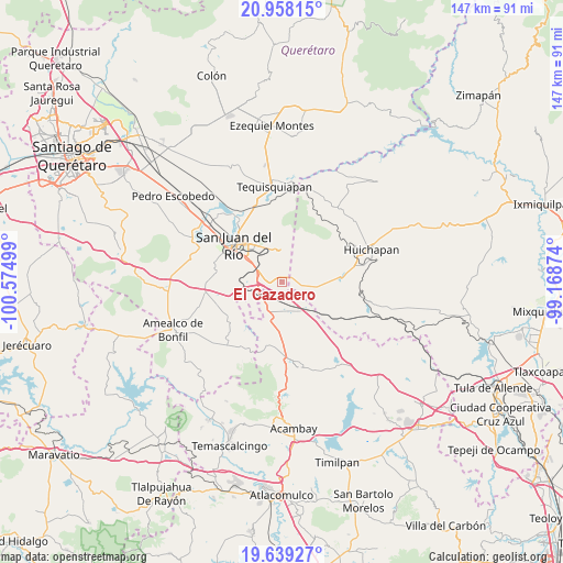
El Cazadero GPS coordinates[2]
20° 18' 0.396" North, 99° 52' 18.696" West
| Map corner | latitude | longitude |
|---|---|---|
| Upper-left | 20.95815°, | -100.57499° |
| Center: | 20.30011°, | -99.87186° |
| Lower-right: | 19.63927°, | -99.16874° |
| Map W x H: | 146.6×146.6 km | = 91.1×91.1mi |
| max Lat: | 32.7° ⇑36.5% North |
| El Cazadero: | 20.30011° |
| min Lat: | ⇓63.5% South 14.53588° |
| min Long | El Cazadero | max Long |
| -117.105° | -99.87186° | -86.73105° |
| W 37.7%⇐ | ⇒62.3% E |
Elevation
Elevation of El Cazadero is 2258 m = 7408 ft, and this is 1004.3 m = 3295 ft above average elevation for this country.
| Max E: |
3497 m = 11473 ft | 15.1% |
| El Cazadero | 2258 m 7408 ft | |
| Avg. | 1253.7 m = 4113 ft | |
Min E: |
-1 m = -3 ft | 84.9% |
See also: Mexico elevation on elevation.city.
Geographical zone
El Cazadero is located in North Torrid zone (between Equator and Tropic of Cancer). Distance of this Northern Tropic circle is 348.8 km =216.7 mi to North.| Distance of | km | miles | from El Cazadero |
|---|---|---|---|
| North Pole | 7749.9 | 4815.6 | to North |
| Arctic Circle | 5144 | 3196.3 | to North |
| Tropic Cancer | 348.8 | 216.7 | to North |
| Equator | 2257.2 | 1402.6 | to South |


Nearby cities:
15 places around El Cazadero: (largest is in red/bold)
• Barrio Lázaro Cárdenas (San Rafael)
6.9 km =4.3 mi,  146°
146°
• Celayita
6.6 km =4.1 mi,  170°
170°
• Cerro Gordo
9.2 km =5.7 mi,  331°
331°
• El Carmen
5.2 km =3.2 mi,  84°
84°
• El Sitio
7.4 km =4.6 mi,  12°
12°
• El Tesoro
5.5 km =3.4 mi,  179°
179°
• La Purísima (Buenavista)
9 km =5.6 mi,  135°
135°
• Palmillas
8.2 km =5.1 mi,  299°
299°
• Paso de Mata
7.4 km =4.6 mi,  309°
309°
• Polotitlán de la Ilustración
10.2 km =6.3 mi, 144°
• Puerta de Palmillas
4.8 km =3 mi,  285°
285°
• San Sebastián de Las Barrancas Sur
7.7 km =4.8 mi,  240°
240°
• Santa Bárbara de La Cueva
9.5 km =5.9 mi,  267°
267°
• Tlaxcalilla
10.4 km =6.5 mi,  34°
34°
• Villas Fundadores [Fraccionamiento]
9.5 km =5.9 mi,  335°
335°
Sources, notices
• [Note1] Compared only with cities in Mexico existing in our database
• [Src1] Map data: © OpenStreetMap contributors (CC-BY-SA)
• [Src2] Other city data from geonames.org with taken over terms of usage.
• [Src3] Geographical zone / Annual Mean Temperature by Robert A. Rohde @ Wikipedia
