Congregación Caballeros geodata
Congregación Caballeros (Tamaulipas) is a populated place; located in Mexico in America/Monterrey (GMT-6) time zone. With population of 836 people, there are 10465 cities with bigger population in this country. Compared to other cities in Mexico, 89.6% of cities are located further ↓South; 52.2% of cities are located further →East and 74.2% of cities have higher elevation than Congregación Caballeros. Note1
Current local time in Congregación Caballeros:
05:09 AM, WednesdayDifference from your time zone: hours


Congregación Caballeros GPS coordinates[2]
23° 51' 44.496" North, 99° 10' 15.42" West
| Map corner | latitude | longitude |
|---|---|---|
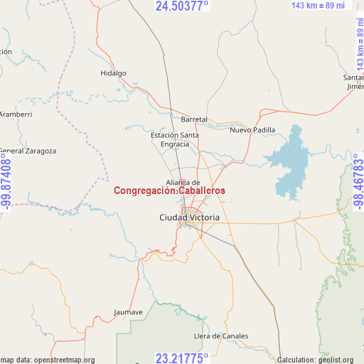
| Upper-left | 24.50377°, | -99.87408° |
| Center: | 23.86236°, | -99.17095° |
| Lower-right: | 23.21775°, | -98.46783° |
| Map W x H: | 143×143 km | = 88.9×88.9mi |
| max Lat: | 32.7° ⇑10.4% North |
| Congregación Caballeros: | 23.86236° |
| min Lat: | ⇓89.6% South 14.53588° |
| min Long | Congregación C | max Long |
| -117.105° | -99.17095° | -86.73105° |
| W 47.8%⇐ | ⇒52.2% E |
Elevation
Elevation of Congregación Caballeros is 246 m = 807 ft, and this is 1007.7 m = 3306 ft below average elevation for this country.
| Max E: |
3497 m = 11473 ft | 74.2% |
| Avg. | 1253.7 m = 4113 ft | |
| Congregación Caballeros | 246 m = 807 ft | |
Min E: |
-1 m = -3 ft | 25.8% |
See also: Mexico elevation on elevation.city.
Geographical zone
Congregación Caballeros is located in North temperate zone (between Tropic of Cancer and the Arctic Circle). Distance of this Northern Tropic circle is 47.3 km =29.4 mi to South.| Distance of | km | miles | from Congregación Caballeros |
|---|---|---|---|
| North Pole | 7353.8 | 4569.4 | to North |
| Arctic Circle | 4747.9 | 2950.2 | to North |
| Tropic Cancer | 47.3 | 29.4 | to South |
| Equator | 2653.2 | 1648.6 | to South |


Nearby cities:
15 places around Congregación Caballeros: (largest is in red/bold)
• Aquiles Serdán
6.2 km =3.9 mi,  140°
140°
• Balconcitos (Balcones)
16.8 km =10.4 mi,  349°
349°
• Benito Juárez
9.9 km =6.2 mi,  158°
158°
• Ciudad Victoria
13.6 km =8.5 mi,  169°
169°
• El Olmo (Rancho Nuevo del Castillo)
20.1 km =12.5 mi,  154°
154°
• Estación Santa Engracia
17.3 km =10.7 mi, 349°
• Guemes
17.9 km =11.1 mi,  69°
69°
• Guillermo Zúñiga
17.3 km =10.7 mi, 349°
• Juan Rincón
7.8 km =4.8 mi,  338°
338°
• La Libertad
8.2 km =5.1 mi,  194°
194°
• La Misión
6.6 km =4.1 mi,  179°
179°
• La Presa
7.3 km =4.5 mi, 178°
• Plan de Ayala
21.7 km =13.5 mi,  13°
13°
• San Cayetano
9 km =5.6 mi,  56°
56°
• San José de la Flores
7.2 km =4.5 mi,  51°
51°
Sources, notices
• [Note1] Compared only with cities in Mexico existing in our database
• [Src1] Map data: © OpenStreetMap contributors (CC-BY-SA)
• [Src2] Other city data from geonames.org with taken over terms of usage.
• [Src3] Geographical zone / Annual Mean Temperature by Robert A. Rohde @ Wikipedia
