Plan de Ayala geodata
Plan de Ayala (Tamaulipas) is a populated place; located in Mexico in America/Monterrey (GMT-6) time zone. With population of 534 people, there are 15868 cities with bigger population in this country. Compared to other cities in Mexico, 90.2% of cities are located further ↓South; 51.4% of cities are located further →East and 75.7% of cities have higher elevation than Plan de Ayala. Note1


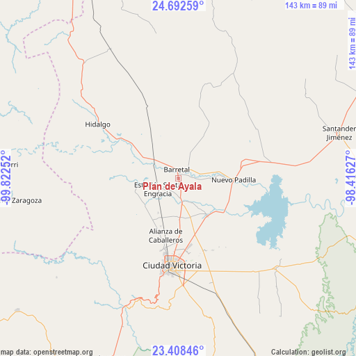
Plan de Ayala GPS coordinates[2]
24° 3' 7.668" North, 99° 7' 9.804" West
| Map corner | latitude | longitude |
|---|---|---|
| Upper-left | 24.69259°, | -99.82252° |
| Center: | 24.05213°, | -99.11939° |
| Lower-right: | 23.40846°, | -98.41627° |
| Map W x H: | 142.8×142.8 km | = 88.7×88.7mi |
| max Lat: | 32.7° ⇑9.8% North |
| Plan de Ayala: | 24.05213° |
| min Lat: | ⇓90.2% South 14.53588° |
| min Long | Plan de Ayala | max Long |
| -117.105° | -99.11939° | -86.73105° |
| W 48.6%⇐ | ⇒51.4% E |
Elevation
Elevation of Plan de Ayala is 199 m = 653 ft, and this is 1054.7 m = 3460 ft below average elevation for this country.
| Max E: |
3497 m = 11473 ft | 75.7% |
| Avg. | 1253.7 m = 4113 ft | |
| Plan de Ayala | 199 m = 653 ft | |
Min E: |
-1 m = -3 ft | 24.3% |
See also: Mexico elevation on elevation.city.
Geographical zone
Plan de Ayala is located in North temperate zone (between Tropic of Cancer and the Arctic Circle). Distance of this Northern Tropic circle is 68.4 km =42.5 mi to South.| Distance of | km | miles | from Plan de Ayala |
|---|---|---|---|
| North Pole | 7332.7 | 4556.3 | to North |
| Arctic Circle | 4726.8 | 2937.1 | to North |
| Tropic Cancer | 68.4 | 42.5 | to South |
| Equator | 2674.3 | 1661.7 | to South |


Nearby cities:
15 places around Plan de Ayala: (largest is in red/bold)
• Aquiles Serdán
25.9 km =16.1 mi,  182°
182°
• Balconcitos (Balcones)
9.6 km =6 mi,  241°
241°
• Barretal
3.5 km =2.2 mi,  350°
350°
• Congregación Caballeros
21.7 km =13.5 mi,  193°
193°
• Cruz y Cruz
8.6 km =5.3 mi,  306°
306°
• Estación Santa Engracia
9.3 km =5.8 mi, 243°
• Guadalupe Victoria
3.5 km =2.2 mi,  315°
315°
• Guemes
18.8 km =11.7 mi,  142°
142°
• Guillermo Zúñiga
9.2 km =5.7 mi, 243°
• Juan Rincón
16 km =9.9 mi,  210°
210°
• La Soledad
5.2 km =3.2 mi,  52°
52°
• Nueva Villa de Padilla
22.2 km =13.8 mi,  91°
91°
• Oyama
16.7 km =10.4 mi,  300°
300°
• San Cayetano
16.3 km =10.1 mi,  172°
172°
• San José de la Flores
16.6 km =10.3 mi, 178°
Sources, notices
• [Note1] Compared only with cities in Mexico existing in our database
• [Src1] Map data: © OpenStreetMap contributors (CC-BY-SA)
• [Src2] Other city data from geonames.org with taken over terms of usage.
• [Src3] Geographical zone / Annual Mean Temperature by Robert A. Rohde @ Wikipedia
