Santiago Tlacotepec geodata
Santiago Tlacotepec (State of Mexico) is a populated place; located in Mexico in America/Mexico_City (GMT-6) time zone. With population of 15,853 people, there are 608 cities with bigger population in this country. Compared to other cities in Mexico, 60.5% of cities are located further ↑North; 59.8% of cities are located further →East and 99% of cities have lower elevation than Santiago Tlacotepec. Note1


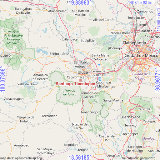
Santiago Tlacotepec GPS coordinates[2]
19° 13' 37.488" North, 99° 40' 14.988" West
| Map corner | latitude | longitude |
|---|---|---|
| Upper-left | 19.88963°, | -100.37396° |
| Center: | 19.22708°, | -99.67083° |
| Lower-right: | 18.56185°, | -98.96771° |
| Map W x H: | 147.6×147.6 km | = 91.7×91.7mi |
| max Lat: | 32.7° ⇑60.5% North |
| Santiago Tlacotepec: | 19.22708° |
| min Lat: | ⇓39.5% South 14.53588° |
| min Long | Santiago Tlacot | max Long |
| -117.105° | -99.67083° | -86.73105° |
| W 40.2%⇐ | ⇒59.8% E |
Elevation
Elevation of Santiago Tlacotepec is 2833 m = 9295 ft, and this is 1579.3 m = 5181 ft above average elevation for this country.
| Max E: |
3497 m = 11473 ft | 1% |
| Santiago Tlacotepec | 2833 m 9295 ft | |
| Avg. | 1253.7 m = 4113 ft | |
Min E: |
-1 m = -3 ft | 99% |
See also: Mexico elevation on elevation.city.
Geographical zone
Santiago Tlacotepec is located in North Torrid zone (between Equator and Tropic of Cancer). Distance of this Northern Tropic circle is 468.1 km =290.9 mi to North.| Distance of | km | miles | from Santiago Tlacotepec |
|---|---|---|---|
| North Pole | 7869.2 | 4889.7 | to North |
| Arctic Circle | 5263.3 | 3270.5 | to North |
| Tropic Cancer | 468.1 | 290.9 | to North |
| Equator | 2137.9 | 1328.4 | to South |


Nearby cities:
15 places around Santiago Tlacotepec: (largest is in red/bold)
• Barrio Santa María
0.9 km =0.6 mi,  310°
310°
• Barrio de la Cruz
2.9 km =1.8 mi,  28°
28°
• Barrio la Venta
4 km =2.5 mi,  66°
66°
• Cacalomacan
4.7 km =2.9 mi, 307°
• Colonia Guadalupe
2 km =1.2 mi,  242°
242°
• Colonia Loma Bonita
1.4 km =0.9 mi,  62°
62°
• Colonia el Mirador (Barrio del Canal)
0.6 km =0.4 mi,  219°
219°
• Colonia el Refugio
2.5 km =1.6 mi,  269°
269°
• Colonia el Tarimoro
3.8 km =2.4 mi,  117°
117°
• Colonia la Joya
1.4 km =0.9 mi,  87°
87°
• San Bartolomé Tlaltelulco
4.3 km =2.7 mi, 89°
• San Buenaventura
4.3 km =2.7 mi,  356°
356°
• San Felipe Tlalmimilolpan
3.3 km =2.1 mi, 65°
• San Juan Tilapa
1.4 km =0.9 mi, 124°
• Santa María Nativitas
4.7 km =2.9 mi,  111°
111°
Sources, notices
• [Note1] Compared only with cities in Mexico existing in our database
• [Src1] Map data: © OpenStreetMap contributors (CC-BY-SA)
• [Src2] Other city data from geonames.org with taken over terms of usage.
• [Src3] Geographical zone / Annual Mean Temperature by Robert A. Rohde @ Wikipedia
