San Pedro Yaneri geodata
San Pedro Yaneri (Oaxaca) is a populated place; located in Mexico in America/Mexico_City (GMT-6) time zone. With population of 579 people, there are 14804 cities with bigger population in this country. Compared to other cities in Mexico, 84% of cities are located further ↑North; 80.6% of cities are located further ←West and 50.9% of cities have higher elevation than San Pedro Yaneri. Note1


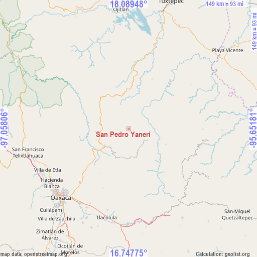
San Pedro Yaneri GPS coordinates[2]
17° 25' 11.46" North, 96° 21' 17.748" West
| Map corner | latitude | longitude |
|---|---|---|
| Upper-left | 18.08948°, | -97.05806° |
| Center: | 17.41985°, | -96.35493° |
| Lower-right: | 16.74775°, | -95.65181° |
| Map W x H: | 149.2×149.2 km | = 92.7×92.7mi |
| max Lat: | 32.7° ⇑84% North |
| San Pedro Yaneri: | 17.41985° |
| min Lat: | ⇓16% South 14.53588° |
| min Long | San Pedro Yaner | max Long |
| -117.105° | -96.35493° | -86.73105° |
| W 80.6%⇐ | ⇒19.4% E |
Elevation
Elevation of San Pedro Yaneri is 1385 m = 4544 ft, and this is 131.3 m = 431 ft above average elevation for this country.
| Max E: |
3497 m = 11473 ft | 50.9% |
| San Pedro Yaneri | 1385 m 4544 ft | |
| Avg. | 1253.7 m = 4113 ft | |
Min E: |
-1 m = -3 ft | 49.1% |
See also: Mexico elevation on elevation.city.
Geographical zone
San Pedro Yaneri is located in North Torrid zone (between Equator and Tropic of Cancer). Distance of this Northern Tropic circle is 669 km =415.7 mi to North.| Distance of | km | miles | from San Pedro Yaneri |
|---|---|---|---|
| North Pole | 8070.2 | 5014.6 | to North |
| Arctic Circle | 5464.3 | 3395.4 | to North |
| Tropic Cancer | 669 | 415.7 | to North |
| Equator | 1936.9 | 1203.5 | to South |


Nearby cities:
15 places around San Pedro Yaneri: (largest is in red/bold)
• Ixtlán de Juárez
17.2 km =10.7 mi,  235°
235°
• La Natividad
15.9 km =9.9 mi,  211°
211°
• La Trinidad de Ixtlán
18.2 km =11.3 mi,  201°
201°
• San Juan Juquila Vijanos
9.1 km =5.7 mi,  143°
143°
• San Juan Yaee
7.7 km =4.8 mi,  81°
81°
• San Miguel Reagui
13.9 km =8.6 mi,  71°
71°
• San Miguel Yotao
5.8 km =3.6 mi,  161°
161°
• Santa Cruz Yagavila
3.9 km =2.4 mi,  59°
59°
• Santa María Yaviche
6.8 km =4.2 mi,  108°
108°
• Santa María Zoogochi
2.2 km =1.4 mi,  53°
53°
• Santiago Camotlán
18.2 km =11.3 mi, 81°
• Santiago Lalopa
11.2 km =7 mi,  91°
91°
• Santiago Teotlasco
4.7 km =2.9 mi, 51°
• Tanetze de Zaragoza
7.5 km =4.7 mi,  130°
130°
• Villa Talea de Castro
13 km =8.1 mi,  120°
120°
Sources, notices
• [Note1] Compared only with cities in Mexico existing in our database
• [Src1] Map data: © OpenStreetMap contributors (CC-BY-SA)
• [Src2] Other city data from geonames.org with taken over terms of usage.
• [Src3] Geographical zone / Annual Mean Temperature by Robert A. Rohde @ Wikipedia
