San Miguel Yotao geodata
San Miguel Yotao (Oaxaca) is a populated place; located in Mexico in America/Mexico_City (GMT-6) time zone. With population of 545 people, there are 15598 cities with bigger population in this country. Compared to other cities in Mexico, 84.5% of cities are located further ↑North; 80.7% of cities are located further ←West and 50.5% of cities have lower elevation than San Miguel Yotao. Note1


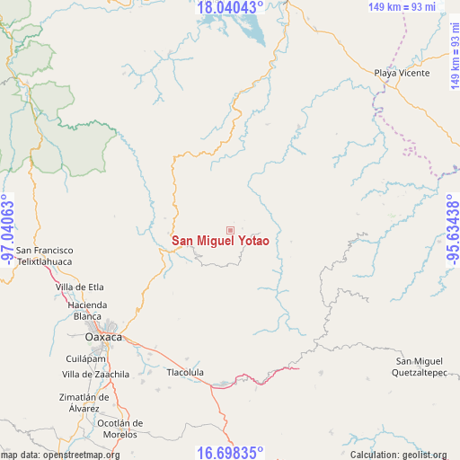
San Miguel Yotao GPS coordinates[2]
17° 22' 14.232" North, 96° 20' 15" West
| Map corner | latitude | longitude |
|---|---|---|
| Upper-left | 18.04043°, | -97.04063° |
| Center: | 17.37062°, | -96.3375° |
| Lower-right: | 16.69835°, | -95.63438° |
| Map W x H: | 149.2×149.2 km | = 92.7×92.7mi |
| max Lat: | 32.7° ⇑84.5% North |
| San Miguel Yotao: | 17.37062° |
| min Lat: | ⇓15.5% South 14.53588° |
| min Long | San Miguel Yota | max Long |
| -117.105° | -96.3375° | -86.73105° |
| W 80.7%⇐ | ⇒19.3% E |
Elevation
Elevation of San Miguel Yotao is 1461 m = 4793 ft, and this is 207.3 m = 680 ft above average elevation for this country.
| Max E: |
3497 m = 11473 ft | 49.5% |
| San Miguel Yotao | 1461 m 4793 ft | |
| Avg. | 1253.7 m = 4113 ft | |
Min E: |
-1 m = -3 ft | 50.5% |
See also: Mexico elevation on elevation.city.
Geographical zone
San Miguel Yotao is located in North Torrid zone (between Equator and Tropic of Cancer). Distance of this Northern Tropic circle is 674.5 km =419.1 mi to North.| Distance of | km | miles | from San Miguel Yotao |
|---|---|---|---|
| North Pole | 8075.6 | 5017.9 | to North |
| Arctic Circle | 5469.7 | 3398.7 | to North |
| Tropic Cancer | 674.5 | 419.1 | to North |
| Equator | 1931.4 | 1200.1 | to South |


Nearby cities:
15 places around San Miguel Yotao: (largest is in red/bold)
• La Natividad
13 km =8.1 mi,  231°
231°
• La Trinidad de Ixtlán
14.3 km =8.9 mi,  216°
216°
• San Andrés Solaga
15.3 km =9.5 mi,  135°
135°
• San Andrés Yatumi
15 km =9.3 mi,  207°
207°
• San Juan Juquila Vijanos
4 km =2.5 mi,  117°
117°
• San Juan Yaee
8.7 km =5.4 mi,  40°
40°
• San Miguel Reagui
15 km =9.3 mi,  48°
48°
• San Pedro Yaneri
5.8 km =3.6 mi,  341°
341°
• Santa Cruz Yagavila
7.6 km =4.7 mi,  11°
11°
• Santa María Yaviche
5.7 km =3.5 mi, 53°
• Santa María Zoogochi
6.8 km =4.2 mi,  359°
359°
• Santiago Lalopa
10.8 km =6.7 mi,  60°
60°
• Santiago Teotlasco
8.6 km =5.3 mi, 12°
• Tanetze de Zaragoza
3.9 km =2.4 mi,  80°
80°
• Villa Talea de Castro
9.4 km =5.8 mi,  97°
97°
Sources, notices
• [Note1] Compared only with cities in Mexico existing in our database
• [Src1] Map data: © OpenStreetMap contributors (CC-BY-SA)
• [Src2] Other city data from geonames.org with taken over terms of usage.
• [Src3] Geographical zone / Annual Mean Temperature by Robert A. Rohde @ Wikipedia
