Santo Domingo Roayaga geodata
Santo Domingo Roayaga (Oaxaca) is a seat of a second-order administrative division; located in Mexico in America/Mexico_City (GMT-6) time zone. With population of 583 people, there are 14713 cities with bigger population in this country. Compared to other cities in Mexico, 84.9% of cities are located further ↑North; 81.8% of cities are located further ←West and 55.9% of cities have lower elevation than Santo Domingo Roayaga. Note1
Current local time in Santo Domingo Roayaga:
08:30 AM, WednesdayDifference from your time zone: hours


Santo Domingo Roayaga GPS coordinates[2]
17° 20' 16.152" North, 96° 6' 54.216" West
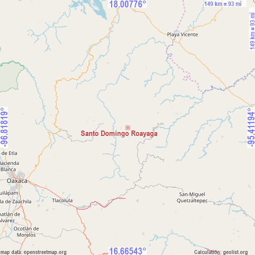
| Map corner | latitude | longitude |
|---|---|---|
| Upper-left | 18.00776°, | -96.81819° |
| Center: | 17.33782°, | -96.11506° |
| Lower-right: | 16.66543°, | -95.41194° |
| Map W x H: | 149.3×149.3 km | = 92.8×92.8mi |
| max Lat: | 32.7° ⇑84.9% North |
| Santo Domingo Roayaga: | 17.33782° |
| min Lat: | ⇓15.1% South 14.53588° |
| min Long | Santo Domingo R | max Long |
| -117.105° | -96.11506° | -86.73105° |
| W 81.8%⇐ | ⇒18.2% E |
Elevation
Elevation of Santo Domingo Roayaga is 1616 m = 5302 ft, and this is 362.3 m = 1189 ft above average elevation for this country.
| Max E: |
3497 m = 11473 ft | 44.1% |
| Santo Domingo Roayaga | 1616 m 5302 ft | |
| Avg. | 1253.7 m = 4113 ft | |
Min E: |
-1 m = -3 ft | 55.9% |
See also: Mexico elevation on elevation.city.
Geographical zone
Santo Domingo Roayaga is located in North Torrid zone (between Equator and Tropic of Cancer). Distance of this Northern Tropic circle is 678.1 km =421.4 mi to North.| Distance of | km | miles | from Santo Domingo Roayaga |
|---|---|---|---|
| North Pole | 8079.3 | 5020.2 | to North |
| Arctic Circle | 5473.4 | 3401 | to North |
| Tropic Cancer | 678.1 | 421.4 | to North |
| Equator | 1927.8 | 1197.9 | to South |


Nearby cities:
15 places around Santo Domingo Roayaga: (largest is in red/bold)
• Chinantequilla
12.9 km =8 mi,  104°
104°
• San Andrés Yaá
6.5 km =4 mi,  219°
219°
• San Cristóbal Lachirioag
5.3 km =3.3 mi,  267°
267°
• San Ildefonso Villa Alta
4 km =2.5 mi, 270°
• San Juan Tabaá
10.4 km =6.5 mi,  249°
249°
• San Juan Yalahui
8 km =5 mi,  341°
341°
• San Juan Yatzona
9.1 km =5.7 mi,  321°
321°
• San Melchor Betaza
10.3 km =6.4 mi,  202°
202°
• Santa María Temaxcalapa
6.8 km =4.2 mi,  313°
313°
• Santa María Tiltepec
11.8 km =7.3 mi,  170°
170°
• Santiago Camotlán
14.1 km =8.8 mi,  328°
328°
• Santiago Tepitongo
9.8 km =6.1 mi,  114°
114°
• Santo Domingo Yojovi
11 km =6.8 mi, 247°
• Totontepec Villa de Morelos
12.9 km =8 mi,  134°
134°
• Villa Talea de Castro
14.5 km =9 mi,  279°
279°
Sources, notices
• [Note1] Compared only with cities in Mexico existing in our database
• [Src1] Map data: © OpenStreetMap contributors (CC-BY-SA)
• [Src2] Other city data from geonames.org with taken over terms of usage.
• [Src3] Geographical zone / Annual Mean Temperature by Robert A. Rohde @ Wikipedia
