Llano Crucero geodata
Llano Crucero (Oaxaca) is a populated place; located in Mexico in America/Mexico_City (GMT-6) time zone. With population of 778 people, there are 11229 cities with bigger population in this country. Compared to other cities in Mexico, 90.2% of cities are located further ↑North; 81.9% of cities are located further ←West and 83.1% of cities have lower elevation than Llano Crucero. Note1


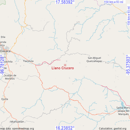
Llano Crucero GPS coordinates[2]
16° 54' 44.712" North, 96° 4' 41.34" West
| Map corner | latitude | longitude |
|---|---|---|
| Upper-left | 17.58392°, | -96.78128° |
| Center: | 16.91242°, | -96.07815° |
| Lower-right: | 16.23852°, | -95.37503° |
| Map W x H: | 149.6×149.6 km | = 93×93mi |
| max Lat: | 32.7° ⇑90.2% North |
| Llano Crucero: | 16.91242° |
| min Lat: | ⇓9.8% South 14.53588° |
| min Long | Llano Crucero | max Long |
| -117.105° | -96.07815° | -86.73105° |
| W 81.9%⇐ | ⇒18.1% E |
Elevation
Elevation of Llano Crucero is 2221 m = 7287 ft, and this is 967.3 m = 3174 ft above average elevation for this country.
| Max E: |
3497 m = 11473 ft | 16.9% |
| Llano Crucero | 2221 m 7287 ft | |
| Avg. | 1253.7 m = 4113 ft | |
Min E: |
-1 m = -3 ft | 83.1% |
See also: Mexico elevation on elevation.city.
Geographical zone
Llano Crucero is located in North Torrid zone (between Equator and Tropic of Cancer). Distance of this Northern Tropic circle is 725.4 km =450.7 mi to North.| Distance of | km | miles | from Llano Crucero |
|---|---|---|---|
| North Pole | 8126.6 | 5049.6 | to North |
| Arctic Circle | 5520.7 | 3430.4 | to North |
| Tropic Cancer | 725.4 | 450.7 | to North |
| Equator | 1880.5 | 1168.5 | to South |


Nearby cities:
15 places around Llano Crucero: (largest is in red/bold)
• Asunción Acatlán
13.8 km =8.6 mi,  97°
97°
• Ayutla
12.8 km =8 mi,  0°
0°
• El Duraznal
16.3 km =10.1 mi,  324°
324°
• Las Peñas
10.9 km =6.8 mi,  30°
30°
• Linda Vista
15 km =9.3 mi,  35°
35°
• San Juan del Río
9.2 km =5.7 mi,  250°
250°
• San Pablo Lachiriega
10.7 km =6.6 mi,  137°
137°
• San Pedro Quiatoni
15.3 km =9.5 mi,  160°
160°
• Santa María Albarradas
13.4 km =8.3 mi,  296°
296°
• Santa María Tepantlali
11.9 km =7.4 mi, 38°
• Santo Domingo Tepuxtepec
5.3 km =3.3 mi,  23°
23°
• Tamazulapam
15.9 km =9.9 mi, 4°
• Tamazulápam del Espíritu Santo
15.9 km =9.9 mi, 4°
• Tierra Blanca
13.2 km =8.2 mi,  14°
14°
• Xambao (Colonia Revolución)
10.8 km =6.7 mi,  56°
56°
Sources, notices
• [Note1] Compared only with cities in Mexico existing in our database
• [Src1] Map data: © OpenStreetMap contributors (CC-BY-SA)
• [Src2] Other city data from geonames.org with taken over terms of usage.
• [Src3] Geographical zone / Annual Mean Temperature by Robert A. Rohde @ Wikipedia
