San Blas Atempa geodata
San Blas Atempa (Oaxaca) is a seat of a second-order administrative division; located in Mexico in America/Mexico_City (GMT-6) time zone. With population of 11,959 people, there are 805 cities with bigger population in this country. Compared to other cities in Mexico, 95.4% of cities are located further ↑North; 83.8% of cities are located further ←West and 83.6% of cities have higher elevation than San Blas Atempa. Note1


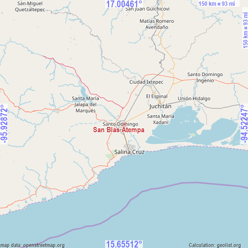
San Blas Atempa GPS coordinates[2]
16° 19' 51.708" North, 95° 13' 32.124" West
| Map corner | latitude | longitude |
|---|---|---|
| Upper-left | 17.00461°, | -95.92872° |
| Center: | 16.33103°, | -95.22559° |
| Lower-right: | 15.65512°, | -94.52247° |
| Map W x H: | 150×150.1 km | = 93.2×93.3mi |
| max Lat: | 32.7° ⇑95.4% North |
| San Blas Atempa: | 16.33103° |
| min Lat: | ⇓4.6% South 14.53588° |
| min Long | San Blas Atempa | max Long |
| -117.105° | -95.22559° | -86.73105° |
| W 83.8%⇐ | ⇒16.2% E |
Elevation
Elevation of San Blas Atempa is 54 m = 177 ft, and this is 1199.7 m = 3936 ft below average elevation for this country.
| Max E: |
3497 m = 11473 ft | 83.6% |
| Avg. | 1253.7 m = 4113 ft | |
| San Blas Atempa | 54 m = 177 ft | |
Min E: |
-1 m = -3 ft | 16.4% |
See also: Mexico elevation on elevation.city.
Geographical zone
San Blas Atempa is located in North Torrid zone (between Equator and Tropic of Cancer). Distance of this Northern Tropic circle is 790.1 km =490.9 mi to North.| Distance of | km | miles | from San Blas Atempa |
|---|---|---|---|
| North Pole | 8191.2 | 5089.8 | to North |
| Arctic Circle | 5585.3 | 3470.5 | to North |
| Tropic Cancer | 790.1 | 490.9 | to North |
| Equator | 1815.8 | 1128.3 | to South |


Nearby cities:
15 places around San Blas Atempa: (largest is in red/bold)
• Boca del Río
15.4 km =9.6 mi,  153°
153°
• Charis
14.5 km =9 mi,  105°
105°
• Colonia Jordán
6.9 km =4.3 mi,  21°
21°
• Colonia San Luis
5.7 km =3.5 mi,  343°
343°
• Fraccionamiento 25 de Enero
9.5 km =5.9 mi, 150°
• Huazantlán del Río
16.2 km =10.1 mi,  140°
140°
• La Noria
8.5 km =5.3 mi,  176°
176°
• Puente Madera
6.6 km =4.1 mi,  45°
45°
• Rancho el Llano
12 km =7.5 mi,  38°
38°
• Rincón Moreno
14.6 km =9.1 mi,  219°
219°
• San Pedro Huilotepec
12.4 km =7.7 mi, 139°
• Santa María Mixtequilla
6.1 km =3.8 mi,  322°
322°
• Santa Rosa
13.6 km =8.5 mi,  96°
96°
• Santo Domingo Tehuantepec
1.8 km =1.1 mi,  246°
246°
• Álvaro Obregón
15.6 km =9.7 mi, 103°
Sources, notices
• [Note1] Compared only with cities in Mexico existing in our database
• [Src1] Map data: © OpenStreetMap contributors (CC-BY-SA)
• [Src2] Other city data from geonames.org with taken over terms of usage.
• [Src3] Geographical zone / Annual Mean Temperature by Robert A. Rohde @ Wikipedia
