Puente Madera geodata
Puente Madera (Oaxaca) is a populated place; located in Mexico in America/Mexico_City (GMT-6) time zone. With population of 506 people, there are 16626 cities with bigger population in this country. Compared to other cities in Mexico, 95.1% of cities are located further ↑North; 84% of cities are located further ←West and 87.5% of cities have higher elevation than Puente Madera. Note1


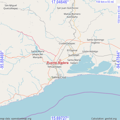
Puente Madera GPS coordinates[2]
16° 22' 22.908" North, 95° 10' 53.616" West
| Map corner | latitude | longitude |
|---|---|---|
| Upper-left | 17.04646°, | -95.88469° |
| Center: | 16.37303°, | -95.18156° |
| Lower-right: | 15.69727°, | -94.47844° |
| Map W x H: | 150×150 km | = 93.2×93.2mi |
| max Lat: | 32.7° ⇑95.1% North |
| Puente Madera: | 16.37303° |
| min Lat: | ⇓4.9% South 14.53588° |
| min Long | Puente Madera | max Long |
| -117.105° | -95.18156° | -86.73105° |
| W 84%⇐ | ⇒16% E |
Elevation
Elevation of Puente Madera is 32 m = 105 ft, and this is 1221.7 m = 4008 ft below average elevation for this country.
| Max E: |
3497 m = 11473 ft | 87.5% |
| Avg. | 1253.7 m = 4113 ft | |
| Puente Madera | 32 m = 105 ft | |
Min E: |
-1 m = -3 ft | 12.5% |
See also: Mexico elevation on elevation.city.
Geographical zone
Puente Madera is located in North Torrid zone (between Equator and Tropic of Cancer). Distance of this Northern Tropic circle is 785.4 km =488 mi to North.| Distance of | km | miles | from Puente Madera |
|---|---|---|---|
| North Pole | 8186.6 | 5086.9 | to North |
| Arctic Circle | 5580.7 | 3467.7 | to North |
| Tropic Cancer | 785.4 | 488 | to North |
| Equator | 1820.5 | 1131.2 | to South |


Nearby cities:
15 places around Puente Madera: (largest is in red/bold)
• Charis
12.6 km =7.8 mi,  132°
132°
• Colonia Jordán
2.8 km =1.7 mi,  308°
308°
• Colonia San Luis
6.4 km =4 mi,  276°
276°
• Fraccionamiento 25 de Enero
13 km =8.1 mi,  180°
180°
• La Noria
13.8 km =8.6 mi,  197°
197°
• Magdalena Tlacotepec
14.7 km =9.1 mi,  351°
351°
• Rancho el Llano
5.4 km =3.4 mi,  30°
30°
• San Blas Atempa
6.6 km =4.1 mi,  225°
225°
• San Pedro Comitancillo
13.4 km =8.3 mi,  11°
11°
• San Pedro Huilotepec
14.5 km =9 mi,  166°
166°
• Santa María Mixtequilla
8.4 km =5.2 mi,  271°
271°
• Santa María Xadani
17.5 km =10.9 mi,  94°
94°
• Santa Rosa
10.8 km =6.7 mi, 125°
• Santo Domingo Tehuantepec
8.3 km =5.2 mi, 229°
• Álvaro Obregón
13.3 km =8.3 mi, 128°
Sources, notices
• [Note1] Compared only with cities in Mexico existing in our database
• [Src1] Map data: © OpenStreetMap contributors (CC-BY-SA)
• [Src2] Other city data from geonames.org with taken over terms of usage.
• [Src3] Geographical zone / Annual Mean Temperature by Robert A. Rohde @ Wikipedia
