Occidente 4ta. Sección geodata
Occidente 4ta. Sección (Tabasco) is a populated place; located in Mexico in America/Mexico_City (GMT-6) time zone. With population of 1,178 people, there are 7369 cities with bigger population in this country. Compared to other cities in Mexico, 74.8% of cities are located further ↑North; 87.4% of cities are located further ←West and 97% of cities have higher elevation than Occidente 4ta. Sección. Note1
Current local time in Occidente 4ta. Sección:
06:48 AM, WednesdayDifference from your time zone: hours


Occidente 4ta. Sección GPS coordinates[2]
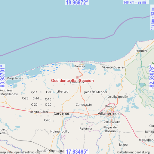
18° 18' 12.492" North, 93° 14' 1.968" West
| Map corner | latitude | longitude |
|---|---|---|
| Upper-left | 18.96972°, | -93.93701° |
| Center: | 18.30347°, | -93.23388° |
| Lower-right: | 17.63465°, | -92.53076° |
| Map W x H: | 148.4×148.4 km | = 92.2×92.2mi |
| max Lat: | 32.7° ⇑74.8% North |
| Occidente 4ta. Sección: | 18.30347° |
| min Lat: | ⇓25.2% South 14.53588° |
| min Long | Occidente 4ta. | max Long |
| -117.105° | -93.23388° | -86.73105° |
| W 87.4%⇐ | ⇒12.6% E |
Elevation
Elevation of Occidente 4ta. Sección is 10 m = 33 ft, and this is 1243.7 m = 4080 ft below average elevation for this country.
| Max E: |
3497 m = 11473 ft | 97% |
| Avg. | 1253.7 m = 4113 ft | |
| Occidente 4ta. Sección | 10 m = 33 ft | |
Min E: |
-1 m = -3 ft | 3% |
See also: Mexico elevation on elevation.city.
Geographical zone
Occidente 4ta. Sección is located in North Torrid zone (between Equator and Tropic of Cancer). Distance of this Northern Tropic circle is 570.8 km =354.7 mi to North.| Distance of | km | miles | from Occidente 4ta. Sección |
|---|---|---|---|
| North Pole | 7971.9 | 4953.5 | to North |
| Arctic Circle | 5366 | 3334.3 | to North |
| Tropic Cancer | 570.8 | 354.7 | to North |
| Equator | 2035.2 | 1264.6 | to South |


Nearby cities:
15 places around Occidente 4ta. Sección: (largest is in red/bold)
• Betania
9.5 km =5.9 mi,  254°
254°
• Chichicapa
7.1 km =4.4 mi,  129°
129°
• Comalcalco
4.6 km =2.9 mi,  166°
166°
• El Tortuguero
5.5 km =3.4 mi,  282°
282°
• Francisco I. Madero
4.8 km =3 mi,  31°
31°
• Gobernadores
8.1 km =5 mi,  140°
140°
• Miguel Hidalgo
9.6 km =6 mi,  237°
237°
• Norte 1ra. Sección (San Julián)
2.6 km =1.6 mi,  95°
95°
• Occidente (San Francisco)
3.7 km =2.3 mi,  327°
327°
• Oriente 1ra. Sección
5.3 km =3.3 mi,  41°
41°
• Oriente 1ra. Sección (Santo Domingo)
5.4 km =3.4 mi, 143°
• Oriente 2da. Sección (Palma Huaca)
5.9 km =3.7 mi,  60°
60°
• Oriente 5ta. Sección (La Candelaria)
9.6 km =6 mi, 169°
• Quintín Arauz
7.9 km =4.9 mi,  11°
11°
• Santa Lucía Chichicapa
7.3 km =4.5 mi,  147°
147°
Sources, notices
• [Note1] Compared only with cities in Mexico existing in our database
• [Src1] Map data: © OpenStreetMap contributors (CC-BY-SA)
• [Src2] Other city data from geonames.org with taken over terms of usage.
• [Src3] Geographical zone / Annual Mean Temperature by Robert A. Rohde @ Wikipedia
