Libertad geodata
Libertad (Tabasco) is a populated place; located in Mexico in America/Mexico_City (GMT-6) time zone. With population of 3,885 people, there are 2354 cities with bigger population in this country. Compared to other cities in Mexico, 76.4% of cities are located further ↑North; 86.9% of cities are located further ←West and 95.1% of cities have higher elevation than Libertad. Note1


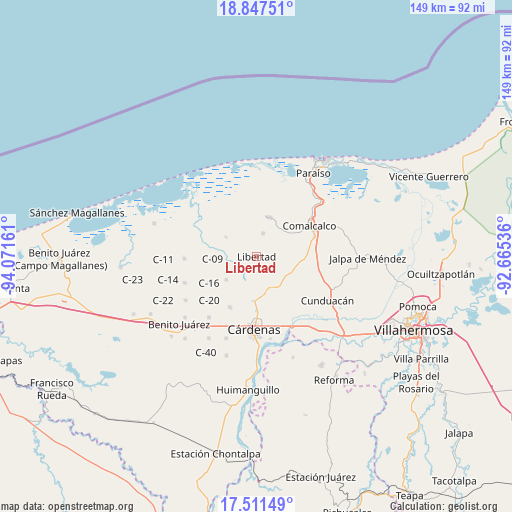
Libertad GPS coordinates[2]
18° 10' 50.808" North, 93° 22' 6.528" West
| Map corner | latitude | longitude |
|---|---|---|
| Upper-left | 18.84751°, | -94.07161° |
| Center: | 18.18078°, | -93.36848° |
| Lower-right: | 17.51149°, | -92.66536° |
| Map W x H: | 148.6×148.6 km | = 92.3×92.3mi |
| max Lat: | 32.7° ⇑76.4% North |
| Libertad: | 18.18078° |
| min Lat: | ⇓23.6% South 14.53588° |
| min Long | Libertad | max Long |
| -117.105° | -93.36848° | -86.73105° |
| W 86.9%⇐ | ⇒13.1% E |
Elevation
Elevation of Libertad is 13 m = 43 ft, and this is 1240.7 m = 4071 ft below average elevation for this country.
| Max E: |
3497 m = 11473 ft | 95.1% |
| Avg. | 1253.7 m = 4113 ft | |
| Libertad | 13 m = 43 ft | |
Min E: |
-1 m = -3 ft | 4.9% |
See also: Mexico elevation on elevation.city.
Geographical zone
Libertad is located in North Torrid zone (between Equator and Tropic of Cancer). Distance of this Northern Tropic circle is 584.4 km =363.1 mi to North.| Distance of | km | miles | from Libertad |
|---|---|---|---|
| North Pole | 7985.5 | 4962 | to North |
| Arctic Circle | 5379.7 | 3342.8 | to North |
| Tropic Cancer | 584.4 | 363.1 | to North |
| Equator | 2021.5 | 1256.1 | to South |


Nearby cities:
15 places around Libertad: (largest is in red/bold)
• Amado Gómez
4 km =2.5 mi,  160°
160°
• Arena 1ra. Sección
2.3 km =1.4 mi,  4°
4°
• Arena 5ta. Sección
5.4 km =3.4 mi,  261°
261°
• Arena 6ta. Sección (La Bolsa)
3.5 km =2.2 mi,  233°
233°
• Carlos Greene 1ra. Sección Tres (Colonia el Limón)
10.2 km =6.3 mi,  295°
295°
• El Tular
4.3 km =2.7 mi,  132°
132°
• Ignacio Gutiérrez Gómez
8.2 km =5.1 mi,  338°
338°
• La Lucha
4.9 km =3 mi,  90°
90°
• Reforma
4.6 km =2.9 mi,  36°
36°
• Rubén Jaramillo Lazo
10 km =6.2 mi,  181°
181°
• Río Seco 1ra. Sección
9.9 km =6.2 mi,  143°
143°
• Santana 2da. Sección B (La Palma)
6.7 km =4.2 mi, 264°
• Santana 5ta. Sección (El Espino)
9.9 km =6.2 mi, 227°
• Sargento López 2da. Sección (El Chuzo)
8.3 km =5.2 mi,  75°
75°
• Villa Aldama
6.9 km =4.3 mi,  15°
15°
Sources, notices
• [Note1] Compared only with cities in Mexico existing in our database
• [Src1] Map data: © OpenStreetMap contributors (CC-BY-SA)
• [Src2] Other city data from geonames.org with taken over terms of usage.
• [Src3] Geographical zone / Annual Mean Temperature by Robert A. Rohde @ Wikipedia
