Villa Aldama geodata
Villa Aldama (Tabasco) is a populated place; located in Mexico in America/Mexico_City (GMT-6) time zone. With population of 5,237 people, there are 1767 cities with bigger population in this country. Compared to other cities in Mexico, 75.7% of cities are located further ↑North; 87% of cities are located further ←West and 95.7% of cities have higher elevation than Villa Aldama. Note1


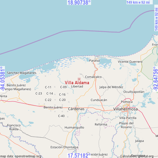
Villa Aldama GPS coordinates[2]
18° 14' 27.168" North, 93° 21' 2.448" West
| Map corner | latitude | longitude |
|---|---|---|
| Upper-left | 18.90738°, | -94.05381° |
| Center: | 18.24088°, | -93.35068° |
| Lower-right: | 17.57182°, | -92.64756° |
| Map W x H: | 148.5×148.5 km | = 92.3×92.3mi |
| max Lat: | 32.7° ⇑75.7% North |
| Villa Aldama: | 18.24088° |
| min Lat: | ⇓24.3% South 14.53588° |
| min Long | Villa Aldama | max Long |
| -117.105° | -93.35068° | -86.73105° |
| W 87%⇐ | ⇒13% E |
Elevation
Elevation of Villa Aldama is 12 m = 39 ft, and this is 1241.7 m = 4074 ft below average elevation for this country.
| Max E: |
3497 m = 11473 ft | 95.7% |
| Avg. | 1253.7 m = 4113 ft | |
| Villa Aldama | 12 m = 39 ft | |
Min E: |
-1 m = -3 ft | 4.3% |
See also: Mexico elevation on elevation.city.
Geographical zone
Villa Aldama is located in North Torrid zone (between Equator and Tropic of Cancer). Distance of this Northern Tropic circle is 577.7 km =359 mi to North.| Distance of | km | miles | from Villa Aldama |
|---|---|---|---|
| North Pole | 7978.9 | 4957.9 | to North |
| Arctic Circle | 5373 | 3338.6 | to North |
| Tropic Cancer | 577.7 | 359 | to North |
| Equator | 2028.2 | 1260.3 | to South |


Nearby cities:
15 places around Villa Aldama: (largest is in red/bold)
• Amado Gómez
10.5 km =6.5 mi,  183°
183°
• Arena 1ra. Sección
4.7 km =2.9 mi,  201°
201°
• Arena 5ta. Sección
10.3 km =6.4 mi,  223°
223°
• Arena 6ta. Sección (La Bolsa)
9.9 km =6.2 mi,  208°
208°
• Betania
5.4 km =3.4 mi,  35°
35°
• El Tular
9.7 km =6 mi,  172°
172°
• Ignacio Gutiérrez Gómez
5 km =3.1 mi,  280°
280°
• Ignacio Zaragoza 1ra. Sección
10.2 km =6.3 mi,  9°
9°
• La Lucha
7.4 km =4.6 mi,  155°
155°
• Libertad
6.9 km =4.3 mi, 195°
• Miguel Hidalgo
4.6 km =2.9 mi,  67°
67°
• Reforma
3.1 km =1.9 mi, 164°
• Sargento López 2da. Sección (El Chuzo)
7.7 km =4.8 mi,  126°
126°
• Sargento López 3ra. Sección (San Jorge)
10.2 km =6.3 mi,  108°
108°
• Villa Tecolutilla
5 km =3.1 mi,  20°
20°
Sources, notices
• [Note1] Compared only with cities in Mexico existing in our database
• [Src1] Map data: © OpenStreetMap contributors (CC-BY-SA)
• [Src2] Other city data from geonames.org with taken over terms of usage.
• [Src3] Geographical zone / Annual Mean Temperature by Robert A. Rohde @ Wikipedia
