Ahuatenco geodata
Ahuatenco (State of Mexico) is a populated place; located in Mexico in America/Mexico_City (GMT-6) time zone. With population of 960 people, there are 9064 cities with bigger population in this country. Compared to other cities in Mexico, 65.9% of cities are located further ↑North; 54.6% of cities are located further →East and 70.7% of cities have lower elevation than Ahuatenco. Note1


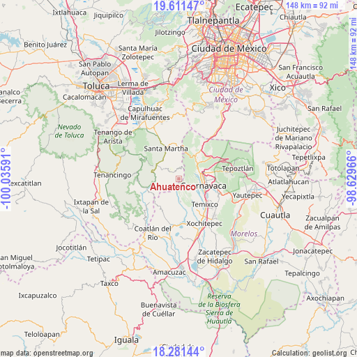
Ahuatenco GPS coordinates[2]
18° 56' 52.008" North, 99° 19' 58.008" West
| Map corner | latitude | longitude |
|---|---|---|
| Upper-left | 19.61147°, | -100.03591° |
| Center: | 18.94778°, | -99.33278° |
| Lower-right: | 18.28144°, | -98.62966° |
| Map W x H: | 147.9×147.9 km | = 91.9×91.9mi |
| max Lat: | 32.7° ⇑65.9% North |
| Ahuatenco: | 18.94778° |
| min Lat: | ⇓34.1% South 14.53588° |
| min Long | Ahuatenco | max Long |
| -117.105° | -99.33278° | -86.73105° |
| W 45.4%⇐ | ⇒54.6% E |
Elevation
Elevation of Ahuatenco is 1939 m = 6362 ft, and this is 685.3 m = 2248 ft above average elevation for this country.
| Max E: |
3497 m = 11473 ft | 29.3% |
| Ahuatenco | 1939 m 6362 ft | |
| Avg. | 1253.7 m = 4113 ft | |
Min E: |
-1 m = -3 ft | 70.7% |
See also: Mexico elevation on elevation.city.
Geographical zone
Ahuatenco is located in North Torrid zone (between Equator and Tropic of Cancer). Distance of this Northern Tropic circle is 499.1 km =310.1 mi to North.| Distance of | km | miles | from Ahuatenco |
|---|---|---|---|
| North Pole | 7900.3 | 4909 | to North |
| Arctic Circle | 5294.4 | 3289.8 | to North |
| Tropic Cancer | 499.1 | 310.1 | to North |
| Equator | 2106.8 | 1309.1 | to South |


Nearby cities:
15 places around Ahuatenco: (largest is in red/bold)
• Buenavista del Monte
2.5 km =1.6 mi,  97°
97°
• Chalmita
9.6 km =6 mi,  261°
261°
• Colonia Doctor Gustavo Baz
9.9 km =6.2 mi,  317°
317°
• Colonia Santa Úrsula
8.9 km =5.5 mi,  137°
137°
• Cuentepec
9.6 km =6 mi,  175°
175°
• Fraccionamiento Lomas de Ahuatlán
8 km =5 mi,  84°
84°
• La Cañada
9.8 km =6.1 mi,  267°
267°
• La Unión
10.5 km =6.5 mi,  123°
123°
• Lomas de Teocaltzingo (Loma de Tecalzingo)
8.3 km =5.2 mi, 319°
• Ocuilan de Arteaga
9.7 km =6 mi,  290°
290°
• San Juan Atzingo
8.9 km =5.5 mi, 321°
• Santa Ana
9.6 km =6 mi,  297°
297°
• Santa Lucía
10.5 km =6.5 mi,  327°
327°
• Santa Mónica
10.8 km =6.7 mi, 297°
• Tepetzingo (Tepezingo)
9.8 km =6.1 mi, 302°
Sources, notices
• [Note1] Compared only with cities in Mexico existing in our database
• [Src1] Map data: © OpenStreetMap contributors (CC-BY-SA)
• [Src2] Other city data from geonames.org with taken over terms of usage.
• [Src3] Geographical zone / Annual Mean Temperature by Robert A. Rohde @ Wikipedia
