El Salitre geodata
El Salitre (State of Mexico) is a populated place; located in Mexico in America/Mexico_City (GMT-6) time zone. With population of 4,544 people, there are 2025 cities with bigger population in this country. Compared to other cities in Mexico, 65.7% of cities are located further ↑North; 58.4% of cities are located further →East and 74.5% of cities have lower elevation than El Salitre. Note1


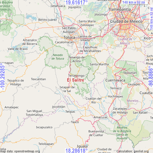
El Salitre GPS coordinates[2]
18° 57' 9" North, 99° 35' 22.992" West
| Map corner | latitude | longitude |
|---|---|---|
| Upper-left | 19.61617°, | -100.29285° |
| Center: | 18.9525°, | -99.58972° |
| Lower-right: | 18.28618°, | -98.8866° |
| Map W x H: | 147.9×147.9 km | = 91.9×91.9mi |
| max Lat: | 32.7° ⇑65.7% North |
| El Salitre: | 18.9525° |
| min Lat: | ⇓34.3% South 14.53588° |
| min Long | El Salitre | max Long |
| -117.105° | -99.58972° | -86.73105° |
| W 41.6%⇐ | ⇒58.4% E |
Elevation
Elevation of El Salitre is 2021 m = 6631 ft, and this is 767.3 m = 2517 ft above average elevation for this country.
| Max E: |
3497 m = 11473 ft | 25.5% |
| El Salitre | 2021 m 6631 ft | |
| Avg. | 1253.7 m = 4113 ft | |
Min E: |
-1 m = -3 ft | 74.5% |
See also: Mexico elevation on elevation.city.
Geographical zone
El Salitre is located in North Torrid zone (between Equator and Tropic of Cancer). Distance of this Northern Tropic circle is 498.6 km =309.8 mi to North.| Distance of | km | miles | from El Salitre |
|---|---|---|---|
| North Pole | 7899.7 | 4908.6 | to North |
| Arctic Circle | 5293.9 | 3289.5 | to North |
| Tropic Cancer | 498.6 | 309.8 | to North |
| Equator | 2107.3 | 1309.4 | to South |


Nearby cities:
15 places around El Salitre: (largest is in red/bold)
• Barrio Santa Teresa
1.9 km =1.2 mi,  320°
320°
• Colonia San Ramón
2.5 km =1.6 mi,  46°
46°
• Ejido Ixpuchiapan
1.8 km =1.1 mi,  109°
109°
• Ejido de Tenería (El Llano)
2.5 km =1.6 mi,  77°
77°
• Ixpuichiapan
2.2 km =1.4 mi,  172°
172°
• La Ciénega
1 km =0.6 mi,  65°
65°
• La Trinidad
1.8 km =1.1 mi,  31°
31°
• Pueblo Nuevo
0.8 km =0.5 mi,  130°
130°
• Quetzalapa
1.5 km =0.9 mi,  209°
209°
• Rinconada de Atotonilco
2.7 km =1.7 mi,  351°
351°
• San Diego
2.3 km =1.4 mi,  11°
11°
• San José el Cuartel
1.5 km =0.9 mi,  58°
58°
• Tenancingo de Degollado
1 km =0.6 mi,  356°
356°
• Tepalcatepec
2.1 km =1.3 mi, 207°
• Tierra Blanca
2.2 km =1.4 mi, 353°
Sources, notices
• [Note1] Compared only with cities in Mexico existing in our database
• [Src1] Map data: © OpenStreetMap contributors (CC-BY-SA)
• [Src2] Other city data from geonames.org with taken over terms of usage.
• [Src3] Geographical zone / Annual Mean Temperature by Robert A. Rohde @ Wikipedia
