San Diego geodata
San Diego (State of Mexico) is a section of populated place; located in Mexico in America/Mexico_City (GMT-6) time zone. With population of 1,063 people, there are 8213 cities with bigger population in this country. Compared to other cities in Mexico, 65.2% of cities are located further ↑North; 58.3% of cities are located further →East and 75.3% of cities have lower elevation than San Diego. Note1


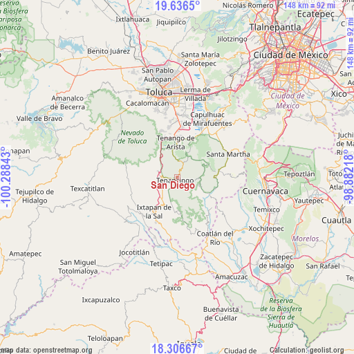
San Diego GPS coordinates[2]
18° 58' 22.476" North, 99° 35' 7.08" West
| Map corner | latitude | longitude |
|---|---|---|
| Upper-left | 19.6365°, | -100.28843° |
| Center: | 18.97291°, | -99.5853° |
| Lower-right: | 18.30667°, | -98.88218° |
| Map W x H: | 147.9×147.9 km | = 91.9×91.9mi |
| max Lat: | 32.7° ⇑65.2% North |
| San Diego: | 18.97291° |
| min Lat: | ⇓34.8% South 14.53588° |
| min Long | San Diego | max Long |
| -117.105° | -99.5853° | -86.73105° |
| W 41.7%⇐ | ⇒58.3% E |
Elevation
Elevation of San Diego is 2036 m = 6680 ft, and this is 782.3 m = 2567 ft above average elevation for this country.
| Max E: |
3497 m = 11473 ft | 24.7% |
| San Diego | 2036 m 6680 ft | |
| Avg. | 1253.7 m = 4113 ft | |
Min E: |
-1 m = -3 ft | 75.3% |
See also: Mexico elevation on elevation.city.
Geographical zone
San Diego is located in North Torrid zone (between Equator and Tropic of Cancer). Distance of this Northern Tropic circle is 496.3 km =308.4 mi to North.| Distance of | km | miles | from San Diego |
|---|---|---|---|
| North Pole | 7897.5 | 4907.3 | to North |
| Arctic Circle | 5291.6 | 3288 | to North |
| Tropic Cancer | 496.3 | 308.4 | to North |
| Equator | 2109.6 | 1310.8 | to South |


Nearby cities:
15 places around San Diego: (largest is in red/bold)
• Barrio Santa Teresa
1.9 km =1.2 mi,  245°
245°
• Chalchihuapan
1.2 km =0.7 mi,  68°
68°
• Colonia San Ramón
1.5 km =0.9 mi,  110°
110°
• Ejido de Tenería (El Llano)
2.6 km =1.6 mi,  131°
131°
• El Salitre
2.3 km =1.4 mi,  191°
191°
• La Ciénega
1.9 km =1.2 mi,  167°
167°
• La Compuerta
1.6 km =1 mi,  286°
286°
• La Mesita
1.2 km =0.7 mi,  20°
20°
• La Trinidad
0.9 km =0.6 mi,  147°
147°
• Pueblo Nuevo
2.8 km =1.7 mi,  177°
177°
• Rinconada de Atotonilco
1 km =0.6 mi, 294°
• San José el Cuartel
1.7 km =1.1 mi, 149°
• San Juan Tetitlán
1.6 km =1 mi,  90°
90°
• Tenancingo de Degollado
1.4 km =0.9 mi,  202°
202°
• Tierra Blanca
0.7 km =0.4 mi,  263°
263°
Sources, notices
• [Note1] Compared only with cities in Mexico existing in our database
• [Src1] Map data: © OpenStreetMap contributors (CC-BY-SA)
• [Src2] Other city data from geonames.org with taken over terms of usage.
• [Src3] Geographical zone / Annual Mean Temperature by Robert A. Rohde @ Wikipedia
