Tlaxcalixtlahuaca geodata
Tlaxcalixtlahuaca (Guerrero) is a populated place; located in Mexico in America/Mexico_City (GMT-6) time zone. With population of 1,441 people, there are 5997 cities with bigger population in this country. Compared to other cities in Mexico, 89.1% of cities are located further ↑North; 53.9% of cities are located further ←West and 67.9% of cities have higher elevation than Tlaxcalixtlahuaca. Note1


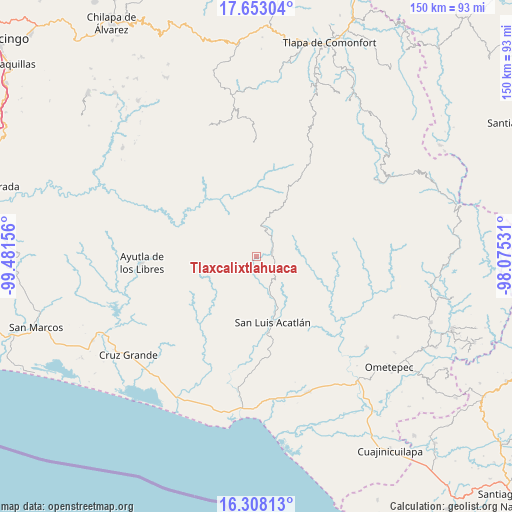
Tlaxcalixtlahuaca GPS coordinates[2]
16° 58' 54.444" North, 98° 46' 42.348" West
| Map corner | latitude | longitude |
|---|---|---|
| Upper-left | 17.65304°, | -99.48156° |
| Center: | 16.98179°, | -98.77843° |
| Lower-right: | 16.30813°, | -98.07531° |
| Map W x H: | 149.5×149.5 km | = 92.9×92.9mi |
| max Lat: | 32.7° ⇑89.1% North |
| Tlaxcalixtlahuaca: | 16.98179° |
| min Lat: | ⇓10.9% South 14.53588° |
| min Long | Tlaxcalixtlahua | max Long |
| -117.105° | -98.77843° | -86.73105° |
| W 53.9%⇐ | ⇒46.1% E |
Elevation
Elevation of Tlaxcalixtlahuaca is 536 m = 1759 ft, and this is 717.7 m = 2355 ft below average elevation for this country.
| Max E: |
3497 m = 11473 ft | 67.9% |
| Avg. | 1253.7 m = 4113 ft | |
| Tlaxcalixtlahuaca | 536 m = 1759 ft | |
Min E: |
-1 m = -3 ft | 32.1% |
See also: Mexico elevation on elevation.city.
Geographical zone
Tlaxcalixtlahuaca is located in North Torrid zone (between Equator and Tropic of Cancer). Distance of this Northern Tropic circle is 717.7 km =446 mi to North.| Distance of | km | miles | from Tlaxcalixtlahuaca |
|---|---|---|---|
| North Pole | 8118.9 | 5044.8 | to North |
| Arctic Circle | 5513 | 3425.6 | to North |
| Tropic Cancer | 717.7 | 446 | to North |
| Equator | 1888.2 | 1173.3 | to South |


Nearby cities:
15 places around Tlaxcalixtlahuaca: (largest is in red/bold)
• Arroyo San Pedro
8.4 km =5.2 mi,  43°
43°
• Aviación
12.8 km =8 mi,  51°
51°
• Cerro Cuate
13.9 km =8.6 mi, 46°
• Colombia de Guadalupe
12 km =7.5 mi,  9°
9°
• El Aserradero
12.1 km =7.5 mi,  76°
76°
• El Potrerillo (Potrerillo del Rincón)
5.7 km =3.5 mi,  117°
117°
• El Rincón (Santa Cruz del Rincón)
4.9 km =3 mi,  70°
70°
• Horcasitas
11 km =6.8 mi,  161°
161°
• Iliatenco
12.1 km =7.5 mi, 54°
• Pascala del Oro
8.8 km =5.5 mi,  337°
337°
• Potrerillo Coapinole
7.9 km =4.9 mi,  102°
102°
• Pueblo Hidalgo
13.4 km =8.3 mi, 104°
• San José Vista Hermosa
10.3 km =6.4 mi, 83°
• Tilapa
8.1 km =5 mi,  22°
22°
• Tuxtepec (Cofradía)
10.4 km =6.5 mi, 97°
Sources, notices
• [Note1] Compared only with cities in Mexico existing in our database
• [Src1] Map data: © OpenStreetMap contributors (CC-BY-SA)
• [Src2] Other city data from geonames.org with taken over terms of usage.
• [Src3] Geographical zone / Annual Mean Temperature by Robert A. Rohde @ Wikipedia
