Los Pescados geodata
Los Pescados (Veracruz) is a populated place; located in Mexico in America/Mexico_City (GMT-6) time zone. With population of 1,555 people, there are 5544 cities with bigger population in this country. Compared to other cities in Mexico, 52.9% of cities are located further ↑North; 73% of cities are located further ←West and 99.8% of cities have lower elevation than Los Pescados. Note1


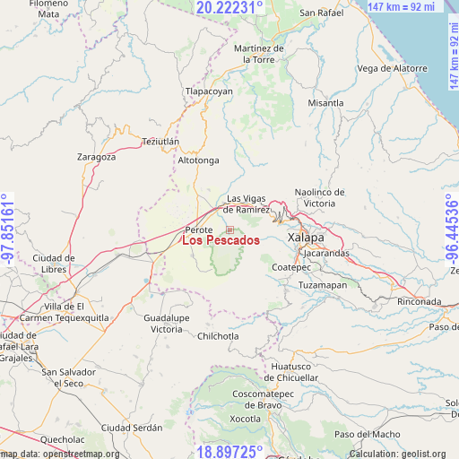
Los Pescados GPS coordinates[2]
19° 33' 40.104" North, 97° 8' 54.528" West
| Map corner | latitude | longitude |
|---|---|---|
| Upper-left | 20.22231°, | -97.85161° |
| Center: | 19.56114°, | -97.14848° |
| Lower-right: | 18.89725°, | -96.44536° |
| Map W x H: | 147.3×147.3 km | = 91.5×91.5mi |
| max Lat: | 32.7° ⇑52.9% North |
| Los Pescados: | 19.56114° |
| min Lat: | ⇓47.1% South 14.53588° |
| min Long | Los Pescados | max Long |
| -117.105° | -97.14848° | -86.73105° |
| W 73%⇐ | ⇒27% E |
Elevation
Elevation of Los Pescados is 2988 m = 9803 ft, and this is 1734.3 m = 5690 ft above average elevation for this country.
| Max E: |
3497 m = 11473 ft | 0.2% |
| Los Pescados | 2988 m 9803 ft | |
| Avg. | 1253.7 m = 4113 ft | |
Min E: |
-1 m = -3 ft | 99.8% |
See also: Mexico elevation on elevation.city.
Geographical zone
Los Pescados is located in North Torrid zone (between Equator and Tropic of Cancer). Distance of this Northern Tropic circle is 430.9 km =267.7 mi to North.| Distance of | km | miles | from Los Pescados |
|---|---|---|---|
| North Pole | 7832.1 | 4866.6 | to North |
| Arctic Circle | 5226.2 | 3247.4 | to North |
| Tropic Cancer | 430.9 | 267.7 | to North |
| Equator | 2175 | 1351.5 | to South |


Nearby cities:
15 places around Los Pescados: (largest is in red/bold)
• Barrio de San Miguel
9.5 km =5.9 mi,  15°
15°
• Centro de Readaptación Social
10.3 km =6.4 mi,  313°
313°
• Cerro de León
9.9 km =6.2 mi,  320°
320°
• Colonia Benito Juárez
6.7 km =4.2 mi,  353°
353°
• Cruz Blanca
8.7 km =5.4 mi, 347°
• El Conejo
3.4 km =2.1 mi,  189°
189°
• El Escobillo
7.3 km =4.5 mi,  224°
224°
• El Paisano
5.3 km =3.3 mi,  74°
74°
• Las Vigas de Ramírez
10 km =6.2 mi,  31°
31°
• Libertad
11.3 km =7 mi,  261°
261°
• Los Molinos
8 km =5 mi,  298°
298°
• Perote
9.8 km =6.1 mi,  270°
270°
• Puentecillas
12 km =7.5 mi,  81°
81°
• Sierra de Agua
7.3 km =4.5 mi, 312°
• Toxtlacuaya
11 km =6.8 mi,  54°
54°
Sources, notices
• [Note1] Compared only with cities in Mexico existing in our database
• [Src1] Map data: © OpenStreetMap contributors (CC-BY-SA)
• [Src2] Other city data from geonames.org with taken over terms of usage.
• [Src3] Geographical zone / Annual Mean Temperature by Robert A. Rohde @ Wikipedia
