La Palma geodata
La Palma (Veracruz) is a populated place; located in Mexico in America/Mexico_City (GMT-6) time zone. With population of 1,392 people, there are 6215 cities with bigger population in this country. Compared to other cities in Mexico, 60.9% of cities are located further ↓South; 74% of cities are located further ←West and 80.3% of cities have higher elevation than La Palma. Note1


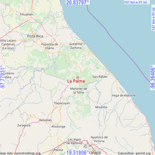
La Palma GPS coordinates[2]
20° 10' 45.876" North, 97° 4' 1.848" West
| Map corner | latitude | longitude |
|---|---|---|
| Upper-left | 20.83797°, | -97.77031° |
| Center: | 20.17941°, | -97.06718° |
| Lower-right: | 19.51806°, | -96.36406° |
| Map W x H: | 146.8×146.8 km | = 91.2×91.2mi |
| max Lat: | 32.7° ⇑39.1% North |
| La Palma: | 20.17941° |
| min Lat: | ⇓60.9% South 14.53588° |
| min Long | La Palma | max Long |
| -117.105° | -97.06718° | -86.73105° |
| W 74%⇐ | ⇒26% E |
Elevation
Elevation of La Palma is 91 m = 299 ft, and this is 1162.7 m = 3815 ft below average elevation for this country.
| Max E: |
3497 m = 11473 ft | 80.3% |
| Avg. | 1253.7 m = 4113 ft | |
| La Palma | 91 m = 299 ft | |
Min E: |
-1 m = -3 ft | 19.7% |
See also: Mexico elevation on elevation.city.
Geographical zone
La Palma is located in North Torrid zone (between Equator and Tropic of Cancer). Distance of this Northern Tropic circle is 362.2 km =225.1 mi to North.| Distance of | km | miles | from La Palma |
|---|---|---|---|
| North Pole | 7763.3 | 4823.9 | to North |
| Arctic Circle | 5157.4 | 3204.7 | to North |
| Tropic Cancer | 362.2 | 225.1 | to North |
| Equator | 2243.7 | 1394.2 | to South |


Nearby cities:
15 places around La Palma: (largest is in red/bold)
• Arroyo Blanco
4 km =2.5 mi,  10°
10°
• Arroyo del Potrero
3.8 km =2.4 mi,  176°
176°
• Balsas de Agua
8 km =5 mi,  313°
313°
• El Faisán
6 km =3.7 mi,  84°
84°
• El Porvenir Número Dos
9.3 km =5.8 mi,  278°
278°
• El Progreso
9.1 km =5.7 mi,  142°
142°
• Huipiltepec
4.9 km =3 mi,  258°
258°
• La Piedrilla
10.8 km =6.7 mi,  147°
147°
• La Unión Paso Largo
8.1 km =5 mi,  120°
120°
• Manantiales
4.6 km =2.9 mi, 261°
• Manuel Ávila Camacho
6.7 km =4.2 mi,  57°
57°
• María de la Torre
9.3 km =5.8 mi,  126°
126°
• Mesa Chica la Gloria
8.4 km =5.2 mi,  302°
302°
• Salvador Díaz Mirón
2.3 km =1.4 mi,  100°
100°
• Zanjas de Arena
6 km =3.7 mi, 60°
Sources, notices
• [Note1] Compared only with cities in Mexico existing in our database
• [Src1] Map data: © OpenStreetMap contributors (CC-BY-SA)
• [Src2] Other city data from geonames.org with taken over terms of usage.
• [Src3] Geographical zone / Annual Mean Temperature by Robert A. Rohde @ Wikipedia
