Jesús María geodata
Jesús María (State of Mexico) is a populated place; located in Mexico in America/Mexico_City (GMT-6) time zone. With population of 1,821 people, there are 4781 cities with bigger population in this country. Compared to other cities in Mexico, 55.9% of cities are located further ↑North; 64% of cities are located further →East and 96.5% of cities have lower elevation than Jesús María. Note1


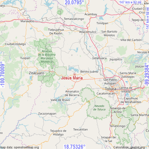
Jesús María GPS coordinates[2]
19° 25' 3.828" North, 99° 59' 49.056" West
| Map corner | latitude | longitude |
|---|---|---|
| Upper-left | 20.0795°, | -100.70009° |
| Center: | 19.41773°, | -99.99696° |
| Lower-right: | 18.75326°, | -99.29384° |
| Map W x H: | 147.5×147.5 km | = 91.7×91.7mi |
| max Lat: | 32.7° ⇑55.9% North |
| Jesús María: | 19.41773° |
| min Lat: | ⇓44.1% South 14.53588° |
| min Long | Jesús María | max Long |
| -117.105° | -99.99696° | -86.73105° |
| W 36%⇐ | ⇒64% E |
Elevation
Elevation of Jesús María is 2653 m = 8704 ft, and this is 1399.3 m = 4591 ft above average elevation for this country.
| Max E: |
3497 m = 11473 ft | 3.5% |
| Jesús María | 2653 m 8704 ft | |
| Avg. | 1253.7 m = 4113 ft | |
Min E: |
-1 m = -3 ft | 96.5% |
See also: Mexico elevation on elevation.city.
Geographical zone
Jesús María is located in North Torrid zone (between Equator and Tropic of Cancer). Distance of this Northern Tropic circle is 446.9 km =277.7 mi to North.| Distance of | km | miles | from Jesús María |
|---|---|---|---|
| North Pole | 7848 | 4876.5 | to North |
| Arctic Circle | 5242.1 | 3257.3 | to North |
| Tropic Cancer | 446.9 | 277.7 | to North |
| Equator | 2159 | 1341.5 | to South |


Nearby cities:
15 places around Jesús María: (largest is in red/bold)
• Barrio el Vivero
5.6 km =3.5 mi,  314°
314°
• Cerritos del Pilar
3.8 km =2.4 mi,  322°
322°
• Dolores Vaquerías
5.4 km =3.4 mi,  263°
263°
• El Fresno San Agustín
1.8 km =1.1 mi,  122°
122°
• Hospital Propiedad (Dos Estrellas)
5.2 km =3.2 mi,  84°
84°
• La Puerta del Pilar
5.1 km =3.2 mi,  337°
337°
• La Unión Berros
3.9 km =2.4 mi,  226°
226°
• Las Peñas
3.6 km =2.2 mi,  355°
355°
• Los Berros
5.8 km =3.6 mi,  247°
247°
• San Agustín Berros
2.2 km =1.4 mi,  220°
220°
• San Agustín Canohillas Primera Sección
5.9 km =3.7 mi,  210°
210°
• San Pedro del Rincón
2.6 km =1.6 mi, 318°
• Santiago del Monte
6.1 km =3.8 mi,  107°
107°
• Turcio Segunda Sección
7 km =4.3 mi,  146°
146°
• Villa Victoria
2.1 km =1.3 mi,  3°
3°
Sources, notices
• [Note1] Compared only with cities in Mexico existing in our database
• [Src1] Map data: © OpenStreetMap contributors (CC-BY-SA)
• [Src2] Other city data from geonames.org with taken over terms of usage.
• [Src3] Geographical zone / Annual Mean Temperature by Robert A. Rohde @ Wikipedia
