Las Peñas geodata
Las Peñas (State of Mexico) is a populated place; located in Mexico in America/Mexico_City (GMT-6) time zone. With population of 1,469 people, there are 5881 cities with bigger population in this country. Compared to other cities in Mexico, 55.1% of cities are located further ↑North; 64% of cities are located further →East and 94.9% of cities have lower elevation than Las Peñas. Note1


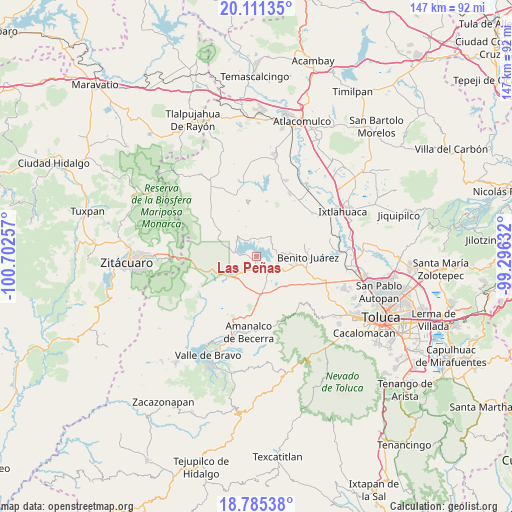
Las Peñas GPS coordinates[2]
19° 26' 58.992" North, 99° 59' 57.984" West
| Map corner | latitude | longitude |
|---|---|---|
| Upper-left | 20.11135°, | -100.70257° |
| Center: | 19.44972°, | -99.99944° |
| Lower-right: | 18.78538°, | -99.29632° |
| Map W x H: | 147.4×147.4 km | = 91.6×91.6mi |
| max Lat: | 32.7° ⇑55.1% North |
| Las Peñas: | 19.44972° |
| min Lat: | ⇓44.9% South 14.53588° |
| min Long | Las Peñas | max Long |
| -117.105° | -99.99944° | -86.73105° |
| W 36%⇐ | ⇒64% E |
Elevation
Elevation of Las Peñas is 2594 m = 8510 ft, and this is 1340.3 m = 4397 ft above average elevation for this country.
| Max E: |
3497 m = 11473 ft | 5.1% |
| Las Peñas | 2594 m 8510 ft | |
| Avg. | 1253.7 m = 4113 ft | |
Min E: |
-1 m = -3 ft | 94.9% |
See also: Mexico elevation on elevation.city.
Geographical zone
Las Peñas is located in North Torrid zone (between Equator and Tropic of Cancer). Distance of this Northern Tropic circle is 443.3 km =275.5 mi to North.| Distance of | km | miles | from Las Peñas |
|---|---|---|---|
| North Pole | 7844.5 | 4874.3 | to North |
| Arctic Circle | 5238.6 | 3255.1 | to North |
| Tropic Cancer | 443.3 | 275.5 | to North |
| Equator | 2162.6 | 1343.8 | to South |


Nearby cities:
15 places around Las Peñas: (largest is in red/bold)
• Barrio el Ocote
6.3 km =3.9 mi,  71°
71°
• Barrio el Vivero
3.8 km =2.4 mi,  275°
275°
• Casas Coloradas
6.3 km =3.9 mi,  294°
294°
• Cerritos del Pilar
2.1 km =1.3 mi,  255°
255°
• El Fresno San Agustín
4.9 km =3 mi,  158°
158°
• Hospital Propiedad (Dos Estrellas)
6.2 km =3.9 mi,  119°
119°
• Jesús María
3.6 km =2.2 mi,  175°
175°
• La Puerta del Pilar
2.1 km =1.3 mi,  304°
304°
• Nuevo Bosque
6.3 km =3.9 mi,  323°
323°
• San Agustín Berros
5.4 km =3.4 mi,  192°
192°
• San Diego del Cerrito
6.5 km =4 mi,  353°
353°
• San Pedro del Rincón
2.2 km =1.4 mi,  222°
222°
• San Roque
5.3 km =3.3 mi,  50°
50°
• Venta de Ocotillos
4.9 km =3 mi,  60°
60°
• Villa Victoria
1.5 km =0.9 mi,  165°
165°
Sources, notices
• [Note1] Compared only with cities in Mexico existing in our database
• [Src1] Map data: © OpenStreetMap contributors (CC-BY-SA)
• [Src2] Other city data from geonames.org with taken over terms of usage.
• [Src3] Geographical zone / Annual Mean Temperature by Robert A. Rohde @ Wikipedia
