Loma de San Felipe geodata
Loma de San Felipe (State of Mexico) is a populated place; located in Mexico in America/Mexico_City (GMT-6) time zone. With population of 579 people, there are 14804 cities with bigger population in this country. Compared to other cities in Mexico, 52.2% of cities are located further ↑North; 59.7% of cities are located further →East and 93.8% of cities have lower elevation than Loma de San Felipe. Note1


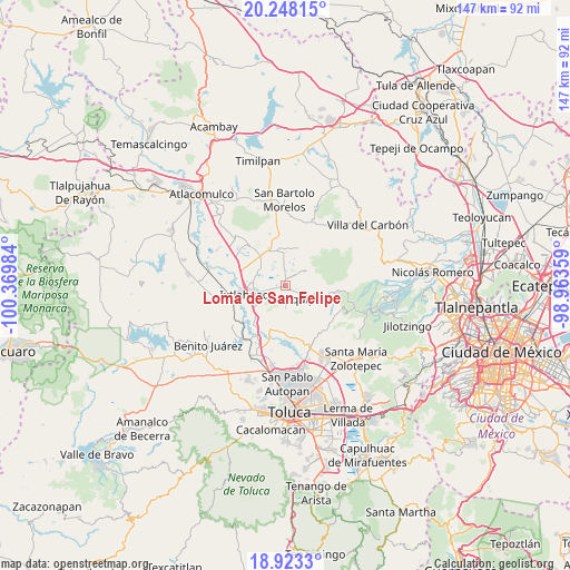
Loma de San Felipe GPS coordinates[2]
19° 35' 13.524" North, 99° 40' 0.156" West
| Map corner | latitude | longitude |
|---|---|---|
| Upper-left | 20.24815°, | -100.36984° |
| Center: | 19.58709°, | -99.66671° |
| Lower-right: | 18.9233°, | -98.96359° |
| Map W x H: | 147.3×147.3 km | = 91.5×91.5mi |
| max Lat: | 32.7° ⇑52.2% North |
| Loma de San Felipe: | 19.58709° |
| min Lat: | ⇓47.8% South 14.53588° |
| min Long | Loma de San Fel | max Long |
| -117.105° | -99.66671° | -86.73105° |
| W 40.3%⇐ | ⇒59.7% E |
Elevation
Elevation of Loma de San Felipe is 2562 m = 8406 ft, and this is 1308.3 m = 4292 ft above average elevation for this country.
| Max E: |
3497 m = 11473 ft | 6.2% |
| Loma de San Felipe | 2562 m 8406 ft | |
| Avg. | 1253.7 m = 4113 ft | |
Min E: |
-1 m = -3 ft | 93.8% |
See also: Mexico elevation on elevation.city.
Geographical zone
Loma de San Felipe is located in North Torrid zone (between Equator and Tropic of Cancer). Distance of this Northern Tropic circle is 428 km =265.9 mi to North.| Distance of | km | miles | from Loma de San Felipe |
|---|---|---|---|
| North Pole | 7829.2 | 4864.8 | to North |
| Arctic Circle | 5223.3 | 3245.6 | to North |
| Tropic Cancer | 428 | 265.9 | to North |
| Equator | 2177.9 | 1353.3 | to South |


Nearby cities:
15 places around Loma de San Felipe: (largest is in red/bold)
• Buenos Aires
3.4 km =2.1 mi,  357°
357°
• Colonia la Purísima
1.4 km =0.9 mi,  218°
218°
• Ejido de Mañi
2.6 km =1.6 mi,  181°
181°
• Ejido de Santa María Nativitas
3.5 km =2.2 mi,  118°
118°
• Loma Hidalgo Colonia Benito Juárez
2.7 km =1.7 mi,  69°
69°
• Loma Vicente Guerrero
1.5 km =0.9 mi,  107°
107°
• Loma del Astillero
0.7 km =0.4 mi,  256°
256°
• Manzana Tercera Loma de Hidalgo
1.3 km =0.8 mi, 73°
• Manzana Tercera de Santa Cruz Tepexpan
4.3 km =2.7 mi,  242°
242°
• Moxteje
4 km =2.5 mi, 117°
• Rancho Alegre
4.6 km =2.9 mi,  337°
337°
• San José del Sitio
1.7 km =1.1 mi,  1°
1°
• Santa María Nativitas
6.1 km =3.8 mi,  98°
98°
• Sección del Cerrito
3.4 km =2.1 mi,  201°
201°
• Tierra Blanca
2.3 km =1.4 mi, 222°
Sources, notices
• [Note1] Compared only with cities in Mexico existing in our database
• [Src1] Map data: © OpenStreetMap contributors (CC-BY-SA)
• [Src2] Other city data from geonames.org with taken over terms of usage.
• [Src3] Geographical zone / Annual Mean Temperature by Robert A. Rohde @ Wikipedia
