San Miguel Totocuitlapilco geodata
San Miguel Totocuitlapilco (State of Mexico) is a populated place; located in Mexico in America/Mexico_City (GMT-6) time zone. With population of 8,207 people, there are 1155 cities with bigger population in this country. Compared to other cities in Mexico, 60.4% of cities are located further ↑North; 58.5% of cities are located further →East and 95.7% of cities have lower elevation than San Miguel Totocuitlapilco. Note1
Current local time in San Miguel Totocuitlapilco:
10:07 AM, MondayDifference from your time zone: hours


San Miguel Totocuitlapilco GPS coordinates[2]
19° 13' 44.004" North, 99° 35' 39.012" West
| Map corner | latitude | longitude |
|---|---|---|
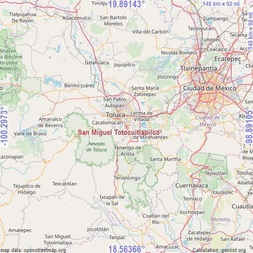
| Upper-left | 19.89143°, | -100.2973° |
| Center: | 19.22889°, | -99.59417° |
| Lower-right: | 18.56366°, | -98.89105° |
| Map W x H: | 147.6×147.6 km | = 91.7×91.7mi |
| max Lat: | 32.7° ⇑60.4% North |
| San Miguel Totocuitlapilco: | 19.22889° |
| min Lat: | ⇓39.6% South 14.53588° |
| min Long | San Miguel Toto | max Long |
| -117.105° | -99.59417° | -86.73105° |
| W 41.5%⇐ | ⇒58.5% E |
Elevation
Elevation of San Miguel Totocuitlapilco is 2616 m = 8583 ft, and this is 1362.3 m = 4469 ft above average elevation for this country.
| Max E: |
3497 m = 11473 ft | 4.3% |
| San Miguel Totocuitlapilco | 2616 m 8583 ft | |
| Avg. | 1253.7 m = 4113 ft | |
Min E: |
-1 m = -3 ft | 95.7% |
See also: Mexico elevation on elevation.city.
Geographical zone
San Miguel Totocuitlapilco is located in North Torrid zone (between Equator and Tropic of Cancer). Distance of this Northern Tropic circle is 467.9 km =290.7 mi to North.| Distance of | km | miles | from San Miguel Totocuitlapilco |
|---|---|---|---|
| North Pole | 7869 | 4889.6 | to North |
| Arctic Circle | 5263.1 | 3270.3 | to North |
| Tropic Cancer | 467.9 | 290.7 | to North |
| Equator | 2138.1 | 1328.6 | to South |


Nearby cities:
15 places around San Miguel Totocuitlapilco: (largest is in red/bold)
• Barrio Santiaguito
3.1 km =1.9 mi,  270°
270°
• Barrio de la Asunción
1.2 km =0.7 mi,  92°
92°
• Chapultepec
4.5 km =2.8 mi,  131°
131°
• Colonia Agrícola Álvaro Obregón
4 km =2.5 mi, 91°
• Colonia Arboledas (San Andrés)
3.3 km =2.1 mi,  154°
154°
• Colonia Llano Grande (El Salitre)
3.7 km =2.3 mi,  60°
60°
• Metepec
3.5 km =2.2 mi,  346°
346°
• Mexicaltzingo
2.2 km =1.4 mi, 153°
• San Andrés Ocotlán
4.1 km =2.5 mi,  168°
168°
• San Bartolomé Tlaltelulco
3.7 km =2.3 mi, 267°
• San Jorge Pueblo Nuevo
4.5 km =2.8 mi,  308°
308°
• San Salvador Tizatlalli
3.5 km =2.2 mi,  5°
5°
• Santa María Magdalena Ocotitlán
3.3 km =2.1 mi,  286°
286°
• Santa María Nativitas
4.2 km =2.6 mi,  242°
242°
• Unidad Habitacional Santa Teresa
4.6 km =2.9 mi,  107°
107°
Sources, notices
• [Note1] Compared only with cities in Mexico existing in our database
• [Src1] Map data: © OpenStreetMap contributors (CC-BY-SA)
• [Src2] Other city data from geonames.org with taken over terms of usage.
• [Src3] Geographical zone / Annual Mean Temperature by Robert A. Rohde @ Wikipedia
