San Juan la Isla geodata
San Juan la Isla (Morelos) is a populated place; located in Mexico in America/Mexico_City (GMT-6) time zone. With population of 2,244 people, there are 3918 cities with bigger population in this country. Compared to other cities in Mexico, 62.6% of cities are located further ↑North; 58% of cities are located further →East and 94.5% of cities have lower elevation than San Juan la Isla. Note1


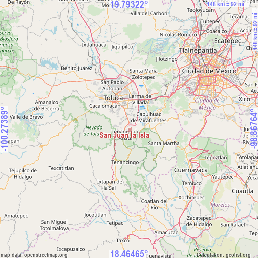
San Juan la Isla GPS coordinates[2]
19° 7' 48.972" North, 99° 34' 14.736" West
| Map corner | latitude | longitude |
|---|---|---|
| Upper-left | 19.79322°, | -100.27389° |
| Center: | 19.13027°, | -99.57076° |
| Lower-right: | 18.46465°, | -98.86764° |
| Map W x H: | 147.7×147.7 km | = 91.8×91.8mi |
| max Lat: | 32.7° ⇑62.6% North |
| San Juan la Isla: | 19.13027° |
| min Lat: | ⇓37.4% South 14.53588° |
| min Long | San Juan la Isl | max Long |
| -117.105° | -99.57076° | -86.73105° |
| W 42%⇐ | ⇒58% E |
Elevation
Elevation of San Juan la Isla is 2584 m = 8478 ft, and this is 1330.3 m = 4365 ft above average elevation for this country.
| Max E: |
3497 m = 11473 ft | 5.5% |
| San Juan la Isla | 2584 m 8478 ft | |
| Avg. | 1253.7 m = 4113 ft | |
Min E: |
-1 m = -3 ft | 94.5% |
See also: Mexico elevation on elevation.city.
Geographical zone
San Juan la Isla is located in North Torrid zone (between Equator and Tropic of Cancer). Distance of this Northern Tropic circle is 478.8 km =297.5 mi to North.| Distance of | km | miles | from San Juan la Isla |
|---|---|---|---|
| North Pole | 7880 | 4896.4 | to North |
| Arctic Circle | 5274.1 | 3277.2 | to North |
| Tropic Cancer | 478.8 | 297.5 | to North |
| Equator | 2127.1 | 1321.7 | to South |


Nearby cities:
15 places around San Juan la Isla: (largest is in red/bold)
• Colonia Cuauhtémoc
3.5 km =2.2 mi,  17°
17°
• Colonia Emiliano Zapata
1.3 km =0.8 mi,  237°
237°
• El Coloso
4.6 km =2.9 mi,  218°
218°
• Ex-Hacienda Santiaguito
0.9 km =0.6 mi, 223°
• Ex-Rancho San Dimas
4.9 km =3 mi,  6°
6°
• La Concepción Coatipac (La Conchita)
5.7 km =3.5 mi,  2°
2°
• Las Cruces
5.4 km =3.4 mi, 221°
• Monte Calvario
3.9 km =2.4 mi, 221°
• San Antonio la Isla
3.8 km =2.4 mi, 6°
• San Francisco Tetetla
3.6 km =2.2 mi, 244°
• San Miguel de Ocampo
5.5 km =3.4 mi,  128°
128°
• San Pedro Techuchulco
5.2 km =3.2 mi,  110°
110°
• Santa María Jajalpa
4.2 km =2.6 mi,  119°
119°
• Santa María Rayón
2.2 km =1.4 mi,  334°
334°
• Tenango de Arista
3.5 km =2.2 mi,  214°
214°
Sources, notices
• [Note1] Compared only with cities in Mexico existing in our database
• [Src1] Map data: © OpenStreetMap contributors (CC-BY-SA)
• [Src2] Other city data from geonames.org with taken over terms of usage.
• [Src3] Geographical zone / Annual Mean Temperature by Robert A. Rohde @ Wikipedia
