Las Cruces geodata
Las Cruces (State of Mexico) is a populated place; located in Mexico in America/Mexico_City (GMT-6) time zone. With population of 647 people, there are 13375 cities with bigger population in this country. Compared to other cities in Mexico, 63.2% of cities are located further ↑North; 58.7% of cities are located further →East and 96.8% of cities have lower elevation than Las Cruces. Note1


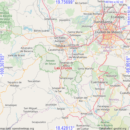
Las Cruces GPS coordinates[2]
19° 5' 38.004" North, 99° 36' 16.992" West
| Map corner | latitude | longitude |
|---|---|---|
| Upper-left | 19.75699°, | -100.30785° |
| Center: | 19.09389°, | -99.60472° |
| Lower-right: | 18.42813°, | -98.9016° |
| Map W x H: | 147.8×147.8 km | = 91.8×91.8mi |
| max Lat: | 32.7° ⇑63.2% North |
| Las Cruces: | 19.09389° |
| min Lat: | ⇓36.8% South 14.53588° |
| min Long | Las Cruces | max Long |
| -117.105° | -99.60472° | -86.73105° |
| W 41.3%⇐ | ⇒58.7% E |
Elevation
Elevation of Las Cruces is 2667 m = 8750 ft, and this is 1413.3 m = 4637 ft above average elevation for this country.
| Max E: |
3497 m = 11473 ft | 3.2% |
| Las Cruces | 2667 m 8750 ft | |
| Avg. | 1253.7 m = 4113 ft | |
Min E: |
-1 m = -3 ft | 96.8% |
See also: Mexico elevation on elevation.city.
Geographical zone
Las Cruces is located in North Torrid zone (between Equator and Tropic of Cancer). Distance of this Northern Tropic circle is 482.9 km =300.1 mi to North.| Distance of | km | miles | from Las Cruces |
|---|---|---|---|
| North Pole | 7884 | 4898.9 | to North |
| Arctic Circle | 5278.1 | 3279.7 | to North |
| Tropic Cancer | 482.9 | 300.1 | to North |
| Equator | 2123 | 1319.2 | to South |


Nearby cities:
15 places around Las Cruces: (largest is in red/bold)
• Colonia Azteca
5.5 km =3.4 mi,  251°
251°
• Colonia Emiliano Zapata
4.2 km =2.6 mi,  36°
36°
• El Coloso
0.8 km =0.5 mi,  59°
59°
• Ex-Hacienda Santiaguito
4.5 km =2.8 mi, 40°
• La Herradura
6.3 km =3.9 mi,  160°
160°
• Monte Calvario
1.5 km =0.9 mi, 40°
• San Bartolomé Atlatlahuca
2.7 km =1.7 mi,  191°
191°
• San Francisco Putla
5 km =3.1 mi,  319°
319°
• San Francisco Tetetla
2.6 km =1.6 mi,  7°
7°
• San Juan la Isla
5.4 km =3.4 mi, 41°
• San Miguel Balderas
5.2 km =3.2 mi,  289°
289°
• San Pedro Tlanixco
6.1 km =3.8 mi,  235°
235°
• Santa Cruz Pueblo Nuevo
5.3 km =3.3 mi,  275°
275°
• Santa Cruz Pueblo Nuevo (Pueblo Nuevo)
5.6 km =3.5 mi, 276°
• Tenango de Arista
2 km =1.2 mi,  53°
53°
Sources, notices
• [Note1] Compared only with cities in Mexico existing in our database
• [Src1] Map data: © OpenStreetMap contributors (CC-BY-SA)
• [Src2] Other city data from geonames.org with taken over terms of usage.
• [Src3] Geographical zone / Annual Mean Temperature by Robert A. Rohde @ Wikipedia
