San Francisco Xochicuautla geodata
San Francisco Xochicuautla (State of Mexico) is a populated place; located in Mexico in America/Mexico_City (GMT-6) time zone. With population of 3,613 people, there are 2539 cities with bigger population in this country. Compared to other cities in Mexico, 57% of cities are located further ↑North; 56.2% of cities are located further →East and 98.6% of cities have lower elevation than San Francisco Xochicuautla. Note1
Current local time in San Francisco Xochicuautla:
08:42 AM, MondayDifference from your time zone: hours


San Francisco Xochicuautla GPS coordinates[2]
19° 22' 22.476" North, 99° 26' 43.08" West
| Map corner | latitude | longitude |
|---|---|---|
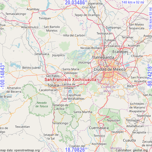
| Upper-left | 20.03486°, | -100.14843° |
| Center: | 19.37291°, | -99.4453° |
| Lower-right: | 18.70826°, | -98.74218° |
| Map W x H: | 147.5×147.5 km | = 91.7×91.7mi |
| max Lat: | 32.7° ⇑57% North |
| San Francisco Xochicuautla: | 19.37291° |
| min Lat: | ⇓43% South 14.53588° |
| min Long | San Francisco X | max Long |
| -117.105° | -99.4453° | -86.73105° |
| W 43.8%⇐ | ⇒56.2% E |
Elevation
Elevation of San Francisco Xochicuautla is 2800 m = 9186 ft, and this is 1546.3 m = 5073 ft above average elevation for this country.
| Max E: |
3497 m = 11473 ft | 1.4% |
| San Francisco Xochicuautla | 2800 m 9186 ft | |
| Avg. | 1253.7 m = 4113 ft | |
Min E: |
-1 m = -3 ft | 98.6% |
See also: Mexico elevation on elevation.city.
Geographical zone
San Francisco Xochicuautla is located in North Torrid zone (between Equator and Tropic of Cancer). Distance of this Northern Tropic circle is 451.9 km =280.8 mi to North.| Distance of | km | miles | from San Francisco Xochicuautla |
|---|---|---|---|
| North Pole | 7853 | 4879.6 | to North |
| Arctic Circle | 5247.1 | 3260.4 | to North |
| Tropic Cancer | 451.9 | 280.8 | to North |
| Equator | 2154.1 | 1338.5 | to South |


Nearby cities:
15 places around San Francisco Xochicuautla: (largest is in red/bold)
• Barranca Grande
3.5 km =2.2 mi,  293°
293°
• Colonia Adolfo López Mateos
3.4 km =2.1 mi,  334°
334°
• Colonia Agrícola Analco
4 km =2.5 mi,  230°
230°
• Colonia Guadalupe Victoria (La Capilla)
3.4 km =2.1 mi,  344°
344°
• Colonia Reforma Tlalmimilolpan
4.9 km =3 mi, 290°
• Colonia Álvaro Obregón
5.2 km =3.2 mi,  274°
274°
• La Concepción Xochicuautla
1.2 km =0.7 mi,  25°
25°
• San Agustín Huitzizilapan
5.6 km =3.5 mi, 339°
• San Nicolás Peralta
4.5 km =2.8 mi,  250°
250°
• San Pedro Huitzizilapan
5 km =3.1 mi,  316°
316°
• Santa Cruz Huitzizilapan
2.7 km =1.7 mi,  353°
353°
• Santa María Atarasquillo
5.5 km =3.4 mi,  206°
206°
• Santa María Tlalmimilolpan
3.4 km =2.1 mi,  307°
307°
• Santiago Analco
4.7 km =2.9 mi,  188°
188°
• Zacamulpa Tlalmimilolpan
1.8 km =1.1 mi,  357°
357°
Sources, notices
• [Note1] Compared only with cities in Mexico existing in our database
• [Src1] Map data: © OpenStreetMap contributors (CC-BY-SA)
• [Src2] Other city data from geonames.org with taken over terms of usage.
• [Src3] Geographical zone / Annual Mean Temperature by Robert A. Rohde @ Wikipedia
