Hidalgo geodata
Hidalgo (Zacatecas) is a populated place; located in Mexico in America/Mexico_City (GMT-6) time zone. With population of 2,373 people, there are 3722 cities with bigger population in this country. Compared to other cities in Mexico, 89.9% of cities are located further ↓South; 88.9% of cities are located further →East and 83.8% of cities have lower elevation than Hidalgo. Note1


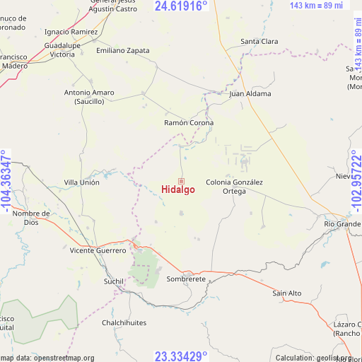
Hidalgo GPS coordinates[2]
23° 58' 41.988" North, 103° 39' 37.224" West
| Map corner | latitude | longitude |
|---|---|---|
| Upper-left | 24.61916°, | -104.36347° |
| Center: | 23.97833°, | -103.66034° |
| Lower-right: | 23.33429°, | -102.95722° |
| Map W x H: | 142.9×142.9 km | = 88.8×88.8mi |
| max Lat: | 32.7° ⇑10.1% North |
| Hidalgo: | 23.97833° |
| min Lat: | ⇓89.9% South 14.53588° |
| min Long | Hidalgo | max Long |
| -117.105° | -103.66034° | -86.73105° |
| W 11.1%⇐ | ⇒88.9% E |
Elevation
Elevation of Hidalgo is 2238 m = 7343 ft, and this is 984.3 m = 3229 ft above average elevation for this country.
| Max E: |
3497 m = 11473 ft | 16.2% |
| Hidalgo | 2238 m 7343 ft | |
| Avg. | 1253.7 m = 4113 ft | |
Min E: |
-1 m = -3 ft | 83.8% |
See also: Mexico elevation on elevation.city.
Geographical zone
Hidalgo is located in North temperate zone (between Tropic of Cancer and the Arctic Circle). Distance of this Northern Tropic circle is 60.2 km =37.4 mi to South.| Distance of | km | miles | from Hidalgo |
|---|---|---|---|
| North Pole | 7340.9 | 4561.4 | to North |
| Arctic Circle | 4735 | 2942.2 | to North |
| Tropic Cancer | 60.2 | 37.4 | to South |
| Equator | 2666.1 | 1656.6 | to South |


Nearby cities:
15 places around Hidalgo: (largest is in red/bold)
• Agua Zarca
18.9 km =11.7 mi,  211°
211°
• Charco Blanco
12.8 km =8 mi,  178°
178°
• Colonia Flores García
23.3 km =14.5 mi,  116°
116°
• Colonia Miguel Alemán
18.8 km =11.7 mi,  83°
83°
• Ejido Zaragoza
3.4 km =2.1 mi, 184°
• Emilio Carranza
14 km =8.7 mi,  357°
357°
• Ignacio López Rayón
27.3 km =17 mi,  347°
347°
• Ignacio Zaragoza
25 km =15.5 mi,  98°
98°
• José María Morelos
23.9 km =14.9 mi,  163°
163°
• José Santos Bañuelos
20.5 km =12.7 mi,  85°
85°
• José Santos Bañuelos (Bañuelos Viejo)
18 km =11.2 mi, 83°
• La Ochoa
26.2 km =16.3 mi,  281°
281°
• Manantial de la Honda (Carboneras)
17.6 km =10.9 mi,  28°
28°
• Ramón Corona
23.3 km =14.5 mi,  7°
7°
• Veracruz
27 km =16.8 mi, 279°
Sources, notices
• [Note1] Compared only with cities in Mexico existing in our database
• [Src1] Map data: © OpenStreetMap contributors (CC-BY-SA)
• [Src2] Other city data from geonames.org with taken over terms of usage.
• [Src3] Geographical zone / Annual Mean Temperature by Robert A. Rohde @ Wikipedia
