Agua Zarca geodata
Agua Zarca (Zacatecas) is a populated place; located in Mexico in America/Mexico_City (GMT-6) time zone. With population of 649 people, there are 13347 cities with bigger population in this country. Compared to other cities in Mexico, 89.5% of cities are located further ↓South; 89.3% of cities are located further →East and 86% of cities have lower elevation than Agua Zarca. Note1


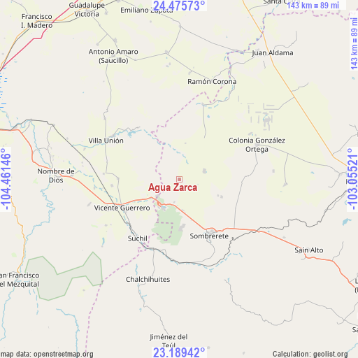
Agua Zarca GPS coordinates[2]
23° 50' 3.012" North, 103° 45' 29.988" West
| Map corner | latitude | longitude |
|---|---|---|
| Upper-left | 24.47573°, | -104.46146° |
| Center: | 23.83417°, | -103.75833° |
| Lower-right: | 23.18942°, | -103.05521° |
| Map W x H: | 143×143 km | = 88.9×88.9mi |
| max Lat: | 32.7° ⇑10.5% North |
| Agua Zarca: | 23.83417° |
| min Lat: | ⇓89.5% South 14.53588° |
| min Long | Agua Zarca | max Long |
| -117.105° | -103.75833° | -86.73105° |
| W 10.7%⇐ | ⇒89.3% E |
Elevation
Elevation of Agua Zarca is 2283 m = 7490 ft, and this is 1029.3 m = 3377 ft above average elevation for this country.
| Max E: |
3497 m = 11473 ft | 14% |
| Agua Zarca | 2283 m 7490 ft | |
| Avg. | 1253.7 m = 4113 ft | |
Min E: |
-1 m = -3 ft | 86% |
See also: Mexico elevation on elevation.city.
Geographical zone
Agua Zarca is located in North temperate zone (between Tropic of Cancer and the Arctic Circle). Distance of this Northern Tropic circle is 44.2 km =27.5 mi to South.| Distance of | km | miles | from Agua Zarca |
|---|---|---|---|
| North Pole | 7357 | 4571.4 | to North |
| Arctic Circle | 4751.1 | 2952.2 | to North |
| Tropic Cancer | 44.2 | 27.5 | to South |
| Equator | 2650.1 | 1646.7 | to South |


Nearby cities:
15 places around Agua Zarca: (largest is in red/bold)
• Charco Blanco
10.7 km =6.6 mi,  72°
72°
• Ejido Zaragoza
15.9 km =9.9 mi,  37°
37°
• Gabriel Hernández (Mancinas)
27.2 km =16.9 mi,  264°
264°
• Hidalgo
18.9 km =11.7 mi,  31°
31°
• José María Morelos
18.2 km =11.3 mi,  112°
112°
• La Joya
24.4 km =15.2 mi,  270°
270°
• La Ochoa
26.3 km =16.3 mi,  323°
323°
• Narciso Mendoza
29 km =18 mi,  313°
313°
• San José de Félix
12.5 km =7.8 mi,  174°
174°
• San Martin
18.1 km =11.2 mi,  177°
177°
• Sombrerete
25.1 km =15.6 mi,  151°
151°
• Súchil
29 km =18 mi,  215°
215°
• Veracruz
26.4 km =16.4 mi, 320°
• Vicente Guerrero
25.6 km =15.9 mi,  244°
244°
• Villa Insurgentes (El Calabazal)
13.3 km =8.3 mi, 220°
Sources, notices
• [Note1] Compared only with cities in Mexico existing in our database
• [Src1] Map data: © OpenStreetMap contributors (CC-BY-SA)
• [Src2] Other city data from geonames.org with taken over terms of usage.
• [Src3] Geographical zone / Annual Mean Temperature by Robert A. Rohde @ Wikipedia
