Eldorado geodata
Eldorado (Sinaloa) is a populated place; located in Mexico in America/Mazatlan (GMT-7) time zone. With population of 13,197 people, there are 744 cities with bigger population in this country. Compared to other cities in Mexico, 90.6% of cities are located further ↓South; 94.8% of cities are located further →East and 96.3% of cities have higher elevation than Eldorado. Note1


Eldorado GPS coordinates[2]
24° 19' 27.984" North, 107° 22' 1.992" West
| Map corner | latitude | longitude |
|---|---|---|
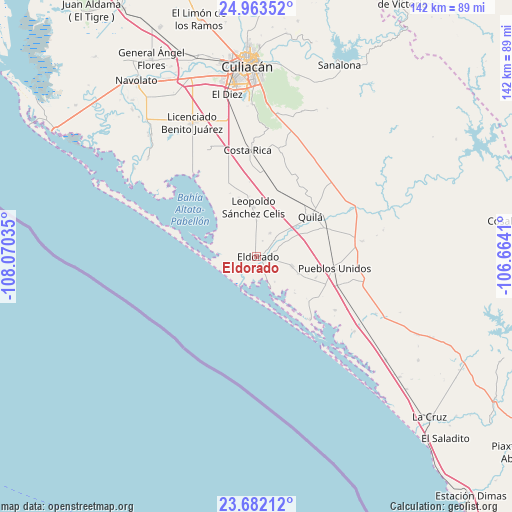
| Upper-left | 24.96352°, | -108.07035° |
| Center: | 24.32444°, | -107.36722° |
| Lower-right: | 23.68212°, | -106.6641° |
| Map W x H: | 142.5×142.5 km | = 88.5×88.5mi |
| max Lat: | 32.7° ⇑9.4% North |
| Eldorado: | 24.32444° |
| min Lat: | ⇓90.6% South 14.53588° |
| min Long | Eldorado | max Long |
| -117.105° | -107.36722° | -86.73105° |
| W 5.2%⇐ | ⇒94.8% E |
Elevation
Elevation of Eldorado is 11 m = 36 ft, and this is 1242.7 m = 4077 ft below average elevation for this country.
| Max E: |
3497 m = 11473 ft | 96.3% |
| Avg. | 1253.7 m = 4113 ft | |
| Eldorado | 11 m = 36 ft | |
Min E: |
-1 m = -3 ft | 3.7% |
See also: Mexico elevation on elevation.city.
Geographical zone
Eldorado is located in North temperate zone (between Tropic of Cancer and the Arctic Circle). Distance of this Northern Tropic circle is 98.7 km =61.3 mi to South.| Distance of | km | miles | from Eldorado |
|---|---|---|---|
| North Pole | 7302.4 | 4537.5 | to North |
| Arctic Circle | 4696.5 | 2918.3 | to North |
| Tropic Cancer | 98.7 | 61.3 | to South |
| Equator | 2704.6 | 1680.6 | to South |


Nearby cities:
15 places around Eldorado: (largest is in red/bold)
• Camalote
9 km =5.6 mi,  48°
48°
• Ejido Mezquitillo (La Curva)
16.8 km =10.4 mi,  353°
353°
• Ejido la Arrocera
15.6 km =9.7 mi, 353°
• El Conchal
9.9 km =6.2 mi,  157°
157°
• El Dorado
0.5 km =0.3 mi,  112°
112°
• El Higueral
2.5 km =1.6 mi,  128°
128°
• El Huinacaxtle
10 km =6.2 mi, 49°
• El Sinaloense
12.6 km =7.8 mi, 112°
• Guadalupe Victoria
10.2 km =6.3 mi, 105°
• La Cruz de Eldorado (Cruz de Navito)
4.8 km =3 mi,  55°
55°
• La Loma (La Loma de Quila)
15.6 km =9.7 mi,  66°
66°
• Las Piedritas
9.8 km =6.1 mi,  0°
0°
• Las Tres Gotas de Agua
11.5 km =7.1 mi,  19°
19°
• Portaceli
6.7 km =4.2 mi, 67°
• San Diego
7.4 km =4.6 mi,  29°
29°
Sources, notices
• [Note1] Compared only with cities in Mexico existing in our database
• [Src1] Map data: © OpenStreetMap contributors (CC-BY-SA)
• [Src2] Other city data from geonames.org with taken over terms of usage.
• [Src3] Geographical zone / Annual Mean Temperature by Robert A. Rohde @ Wikipedia
