Camalú geodata
Camalú (Baja California) is a populated place; located in Mexico in America/Tijuana (GMT-7) time zone. With population of 8,621 people, there are 1104 cities with bigger population in this country. Compared to other cities in Mexico, 98.9% of cities are located further ↓South; 99.6% of cities are located further →East and 87.5% of cities have higher elevation than Camalú. Note1


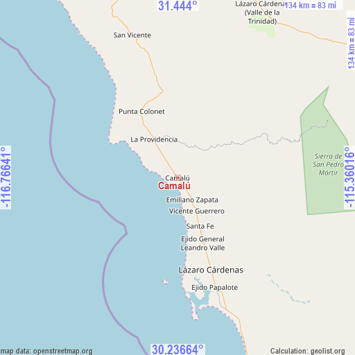
Camalú GPS coordinates[2]
30° 50' 31.992" North, 116° 3' 47.808" West
| Map corner | latitude | longitude |
|---|---|---|
| Upper-left | 31.444°, | -116.76641° |
| Center: | 30.84222°, | -116.06328° |
| Lower-right: | 30.23664°, | -115.36016° |
| Map W x H: | 134.2×134.2 km | = 83.4×83.4mi |
| max Lat: | 32.7° ⇑1.1% North |
| Camalú: | 30.84222° |
| min Lat: | ⇓98.9% South 14.53588° |
| min Long | Camalú | max Long |
| -117.105° | -116.06328° | -86.73105° |
| W 0.4%⇐ | ⇒99.6% E |
Elevation
Elevation of Camalú is 32 m = 105 ft, and this is 1221.7 m = 4008 ft below average elevation for this country.
| Max E: |
3497 m = 11473 ft | 87.5% |
| Avg. | 1253.7 m = 4113 ft | |
| Camalú | 32 m = 105 ft | |
Min E: |
-1 m = -3 ft | 12.5% |
See also: Mexico elevation on elevation.city.
Geographical zone
Camalú is located in North temperate zone (between Tropic of Cancer and the Arctic Circle). Distance of this Northern Tropic circle is 823.4 km =511.6 mi to South.| Distance of | km | miles | from Camalú |
|---|---|---|---|
| North Pole | 6577.7 | 4087.2 | to North |
| Arctic Circle | 3971.8 | 2468 | to North |
| Tropic Cancer | 823.4 | 511.6 | to South |
| Equator | 3429.3 | 2130.9 | to South |


Nearby cities:
15 places around Camalú: (largest is in red/bold)
• Colonia Lomas de San Ramón (Triquis)
16.7 km =10.4 mi,  159°
159°
• Colonia Militar Elpidio Berlanga de León
5.9 km =3.7 mi,  143°
143°
• Ejido General Leandro Valle
26.2 km =16.3 mi, 159°
• Emiliano Zapata
11.4 km =7.1 mi,  149°
149°
• La Providencia
16.8 km =10.4 mi,  327°
327°
• Las Brisas
16.3 km =10.1 mi,  323°
323°
• Licenciado Gustavo Díaz Ordaz
17.2 km =10.7 mi, 329°
• Lázaro Cárdenas
37.3 km =23.2 mi, 159°
• Playas de la Vicente Guerrero
19.3 km =12 mi, 156°
• Poblado Chulavista (El Chorizo)
12 km =7.5 mi, 151°
• Pueblo Benito García
38.4 km =23.9 mi, 161°
• San Quintín
32 km =19.9 mi, 159°
• Santa Candelaria
1.3 km =0.8 mi,  175°
175°
• Santa Fé
19.9 km =12.4 mi, 155°
• Vicente Guerrero
14.2 km =8.8 mi, 150°
Sources, notices
• [Note1] Compared only with cities in Mexico existing in our database
• [Src1] Map data: © OpenStreetMap contributors (CC-BY-SA)
• [Src2] Other city data from geonames.org with taken over terms of usage.
• [Src3] Geographical zone / Annual Mean Temperature by Robert A. Rohde @ Wikipedia
