Villa Cardenas geodata
Villa Cardenas (Zacatecas) is a populated place; located in Mexico in America/Mexico_City (GMT-6) time zone. With population of 603 people, there are 14266 cities with bigger population in this country. Compared to other cities in Mexico, 90.5% of cities are located further ↓South; 86.1% of cities are located further →East and 81.7% of cities have lower elevation than Villa Cardenas. Note1


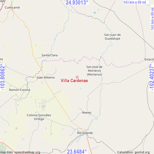
Villa Cardenas GPS coordinates[2]
24° 17' 27.168" North, 103° 6' 19.764" West
| Map corner | latitude | longitude |
|---|---|---|
| Upper-left | 24.93013°, | -103.80862° |
| Center: | 24.29088°, | -103.10549° |
| Lower-right: | 23.6484°, | -102.40237° |
| Map W x H: | 142.5×142.5 km | = 88.5×88.5mi |
| max Lat: | 32.7° ⇑9.5% North |
| Villa Cardenas: | 24.29088° |
| min Lat: | ⇓90.5% South 14.53588° |
| min Long | Villa Cardenas | max Long |
| -117.105° | -103.10549° | -86.73105° |
| W 13.9%⇐ | ⇒86.1% E |
Elevation
Elevation of Villa Cardenas is 2181 m = 7156 ft, and this is 927.3 m = 3042 ft above average elevation for this country.
| Max E: |
3497 m = 11473 ft | 18.3% |
| Villa Cardenas | 2181 m 7156 ft | |
| Avg. | 1253.7 m = 4113 ft | |
Min E: |
-1 m = -3 ft | 81.7% |
See also: Mexico elevation on elevation.city.
Geographical zone
Villa Cardenas is located in North temperate zone (between Tropic of Cancer and the Arctic Circle). Distance of this Northern Tropic circle is 95 km =59 mi to South.| Distance of | km | miles | from Villa Cardenas |
|---|---|---|---|
| North Pole | 7306.2 | 4539.9 | to North |
| Arctic Circle | 4700.3 | 2920.6 | to North |
| Tropic Cancer | 95 | 59 | to South |
| Equator | 2700.9 | 1678.3 | to South |


Nearby cities:
15 places around Villa Cardenas: (largest is in red/bold)
• Cieneguilla (Noria y Cieneguilla)
28.7 km =17.8 mi,  178°
178°
• Espiritu Santo
19 km =11.8 mi,  230°
230°
• General Juan José Ríos
30.7 km =19.1 mi,  277°
277°
• Independencia San Martín (San Martín)
25.7 km =16 mi, 175°
• Juan Aldama
29.1 km =18.1 mi,  270°
270°
• La Laguna
11.6 km =7.2 mi,  222°
222°
• Luis Moya
28 km =17.4 mi,  131°
131°
• Miguel Auza
35 km =21.7 mi, 270°
• Nieves
33.9 km =21.1 mi,  165°
165°
• Ojitos
24.5 km =15.2 mi, 274°
• San Antonio de la Laguna
35.2 km =21.9 mi,  286°
286°
• San Jose de Reyes
16.8 km =10.4 mi,  351°
351°
• San José de Morteros
17.5 km =10.9 mi,  68°
68°
• San Lucas de Abajo
11 km =6.8 mi, 177°
• Santa Clara
32.7 km =20.3 mi,  308°
308°
Sources, notices
• [Note1] Compared only with cities in Mexico existing in our database
• [Src1] Map data: © OpenStreetMap contributors (CC-BY-SA)
• [Src2] Other city data from geonames.org with taken over terms of usage.
• [Src3] Geographical zone / Annual Mean Temperature by Robert A. Rohde @ Wikipedia
