Suchitlán geodata
Suchitlán (Guanajuato) is a populated place; located in Mexico in America/Mexico_City (GMT-6) time zone. With population of 1,676 people, there are 5176 cities with bigger population in this country. Compared to other cities in Mexico, 68.6% of cities are located further ↓South; 73.6% of cities are located further →East and 60.3% of cities have lower elevation than Suchitlán. Note1


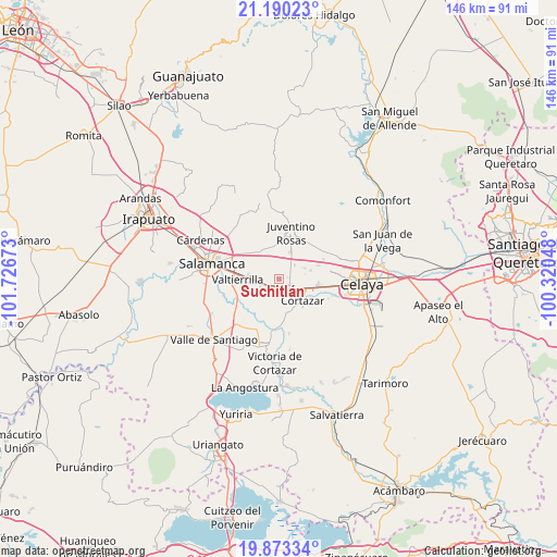
Suchitlán GPS coordinates[2]
20° 31' 59.52" North, 101° 1' 24.96" West
| Map corner | latitude | longitude |
|---|---|---|
| Upper-left | 21.19023°, | -101.72673° |
| Center: | 20.5332°, | -101.0236° |
| Lower-right: | 19.87334°, | -100.32048° |
| Map W x H: | 146.4×146.4 km | = 91×91mi |
| max Lat: | 32.7° ⇑31.4% North |
| Suchitlán: | 20.5332° |
| min Lat: | ⇓68.6% South 14.53588° |
| min Long | Suchitlán | max Long |
| -117.105° | -101.0236° | -86.73105° |
| W 26.4%⇐ | ⇒73.6% E |
Elevation
Elevation of Suchitlán is 1730 m = 5676 ft, and this is 476.3 m = 1563 ft above average elevation for this country.
| Max E: |
3497 m = 11473 ft | 39.7% |
| Suchitlán | 1730 m 5676 ft | |
| Avg. | 1253.7 m = 4113 ft | |
Min E: |
-1 m = -3 ft | 60.3% |
See also: Mexico elevation on elevation.city.
Geographical zone
Suchitlán is located in North Torrid zone (between Equator and Tropic of Cancer). Distance of this Northern Tropic circle is 322.8 km =200.6 mi to North.| Distance of | km | miles | from Suchitlán |
|---|---|---|---|
| North Pole | 7724 | 4799.5 | to North |
| Arctic Circle | 5118.1 | 3180.2 | to North |
| Tropic Cancer | 322.8 | 200.6 | to North |
| Equator | 2283.1 | 1418.7 | to South |


Nearby cities:
15 places around Suchitlán: (largest is in red/bold)
• Campo Sarabia
5.8 km =3.6 mi,  232°
232°
• Colonia 18 de Marzo
2.8 km =1.7 mi,  333°
333°
• Colonia Emiliano Zapata
5.4 km =3.4 mi,  124°
124°
• Colonia la Calzada (La Olla)
7.5 km =4.7 mi, 116°
• Cortazar
8.4 km =5.2 mi,  130°
130°
• El Caracol
5.7 km =3.5 mi,  48°
48°
• El Nacimiento
7.8 km =4.8 mi,  217°
217°
• Fraccionamiento Praderas de la Venta
2.5 km =1.6 mi,  82°
82°
• Godoy
7.5 km =4.7 mi,  292°
292°
• Mexicanos
4.9 km =3 mi,  264°
264°
• San Salvador Torrecillas
7.5 km =4.7 mi,  66°
66°
• Santiago de Cuenda
8 km =5 mi,  22°
22°
• Sarabia
4.1 km =2.5 mi,  253°
253°
• Tierra Fría
8.1 km =5 mi,  191°
191°
• Villagrán
3.4 km =2.1 mi, 127°
Sources, notices
• [Note1] Compared only with cities in Mexico existing in our database
• [Src1] Map data: © OpenStreetMap contributors (CC-BY-SA)
• [Src2] Other city data from geonames.org with taken over terms of usage.
• [Src3] Geographical zone / Annual Mean Temperature by Robert A. Rohde @ Wikipedia
