Godoy geodata
Godoy (Guanajuato) is a populated place; located in Mexico in America/Mexico_City (GMT-6) time zone. With population of 770 people, there are 11354 cities with bigger population in this country. Compared to other cities in Mexico, 69.1% of cities are located further ↓South; 74.2% of cities are located further →East and 59.8% of cities have lower elevation than Godoy. Note1


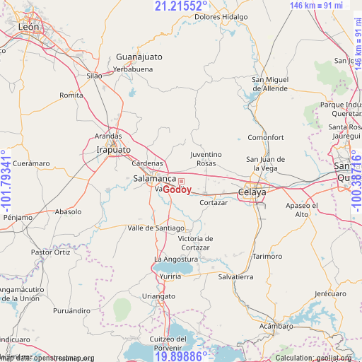
Godoy GPS coordinates[2]
20° 33' 30.996" North, 101° 5' 25.008" West
| Map corner | latitude | longitude |
|---|---|---|
| Upper-left | 21.21552°, | -101.79341° |
| Center: | 20.55861°, | -101.09028° |
| Lower-right: | 19.89886°, | -100.38716° |
| Map W x H: | 146.4×146.4 km | = 91×91mi |
| max Lat: | 32.7° ⇑30.9% North |
| Godoy: | 20.55861° |
| min Lat: | ⇓69.1% South 14.53588° |
| min Long | Godoy | max Long |
| -117.105° | -101.09028° | -86.73105° |
| W 25.8%⇐ | ⇒74.2% E |
Elevation
Elevation of Godoy is 1723 m = 5653 ft, and this is 469.3 m = 1540 ft above average elevation for this country.
| Max E: |
3497 m = 11473 ft | 40.2% |
| Godoy | 1723 m 5653 ft | |
| Avg. | 1253.7 m = 4113 ft | |
Min E: |
-1 m = -3 ft | 59.8% |
See also: Mexico elevation on elevation.city.
Geographical zone
Godoy is located in North Torrid zone (between Equator and Tropic of Cancer). Distance of this Northern Tropic circle is 320 km =198.8 mi to North.| Distance of | km | miles | from Godoy |
|---|---|---|---|
| North Pole | 7721.2 | 4797.7 | to North |
| Arctic Circle | 5115.3 | 3178.5 | to North |
| Tropic Cancer | 320 | 198.8 | to North |
| Equator | 2285.9 | 1420.4 | to South |


Nearby cities:
15 places around Godoy: (largest is in red/bold)
• Campo Sarabia
6.7 km =4.2 mi,  159°
159°
• Cerrito de Gasca
7.3 km =4.5 mi,  23°
23°
• Cerro Gordo
5.4 km =3.4 mi,  315°
315°
• Colonia 18 de Marzo
5.7 km =3.5 mi,  93°
93°
• El Divisador
7.4 km =4.6 mi,  286°
286°
• Emiliano Zapata
8.2 km =5.1 mi,  36°
36°
• Las Liebres
8.6 km =5.3 mi,  335°
335°
• Mexicanos
3.9 km =2.4 mi,  148°
148°
• San José de la Montaña
5 km =3.1 mi, 21°
• Santa Rita
4.3 km =2.7 mi,  0°
0°
• Sarabia
5 km =3.1 mi,  143°
143°
• Suchitlán
7.5 km =4.7 mi,  112°
112°
• Valencia de Cerro Gordo
4.8 km =3 mi,  10°
10°
• Valtierrilla
4.9 km =3 mi,  233°
233°
• Zapote de Palomas
3.9 km =2.4 mi, 318°
Sources, notices
• [Note1] Compared only with cities in Mexico existing in our database
• [Src1] Map data: © OpenStreetMap contributors (CC-BY-SA)
• [Src2] Other city data from geonames.org with taken over terms of usage.
• [Src3] Geographical zone / Annual Mean Temperature by Robert A. Rohde @ Wikipedia
