San Lucas Texcaltitlán geodata
San Lucas Texcaltitlán (State of Mexico) is a populated place; located in Mexico in America/Mexico_City (GMT-6) time zone. With population of 1,430 people, there are 6038 cities with bigger population in this country. Compared to other cities in Mexico, 58.8% of cities are located further ↑North; 66.2% of cities are located further →East and 80.3% of cities have lower elevation than San Lucas Texcaltitlán. Note1
Current local time in San Lucas Texcaltitlán:
08:44 AM, WednesdayDifference from your time zone: hours


San Lucas Texcaltitlán GPS coordinates[2]
19° 18' 2.34" North, 100° 10' 17.868" West
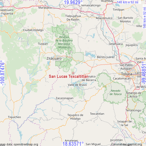
| Map corner | latitude | longitude |
|---|---|---|
| Upper-left | 19.9629°, | -100.87476° |
| Center: | 19.30065°, | -100.17163° |
| Lower-right: | 18.63571°, | -99.46851° |
| Map W x H: | 147.6×147.6 km | = 91.7×91.7mi |
| max Lat: | 32.7° ⇑58.8% North |
| San Lucas Texcaltitlán: | 19.30065° |
| min Lat: | ⇓41.2% South 14.53588° |
| min Long | San Lucas Texca | max Long |
| -117.105° | -100.17163° | -86.73105° |
| W 33.8%⇐ | ⇒66.2% E |
Elevation
Elevation of San Lucas Texcaltitlán is 2146 m = 7041 ft, and this is 892.3 m = 2927 ft above average elevation for this country.
| Max E: |
3497 m = 11473 ft | 19.7% |
| San Lucas Texcaltitlán | 2146 m 7041 ft | |
| Avg. | 1253.7 m = 4113 ft | |
Min E: |
-1 m = -3 ft | 80.3% |
See also: Mexico elevation on elevation.city.
Geographical zone
San Lucas Texcaltitlán is located in North Torrid zone (between Equator and Tropic of Cancer). Distance of this Northern Tropic circle is 459.9 km =285.8 mi to North.| Distance of | km | miles | from San Lucas Texcaltitlán |
|---|---|---|---|
| North Pole | 7861 | 4884.6 | to North |
| Arctic Circle | 5255.1 | 3265.4 | to North |
| Tropic Cancer | 459.9 | 285.8 | to North |
| Equator | 2146 | 1333.5 | to South |


Nearby cities:
15 places around San Lucas Texcaltitlán: (largest is in red/bold)
• Barrio Chiquichuca
4.9 km =3 mi,  298°
298°
• Casa Blanca
7 km =4.3 mi,  3°
3°
• El Aventurero
4.7 km =2.9 mi,  278°
278°
• Mesas Altas de Xoconusco
8.6 km =5.3 mi, 295°
• Mesas de San Jerónimo
4.4 km =2.7 mi,  311°
311°
• San Agustín de las Palmas
3.7 km =2.3 mi,  39°
39°
• San Antonio Hidalgo (Ranchería de San Antonio)
7.5 km =4.7 mi,  76°
76°
• San Gabriel Ixtla
6.9 km =4.3 mi,  133°
133°
• San Ildefonso
6.5 km =4 mi,  33°
33°
• San Jerónimo Totoltepec
3.6 km =2.2 mi, 295°
• San José Villa de Allende
8.6 km =5.3 mi,  16°
16°
• San Pablo Malacatepec
8.1 km =5 mi,  11°
11°
• Santa Teresa Tiloxtoc
8.5 km =5.3 mi,  199°
199°
• Santiago Huitlapaltepec
4 km =2.5 mi,  247°
247°
• Vare Chiquichuca
6.6 km =4.1 mi,  338°
338°
Sources, notices
• [Note1] Compared only with cities in Mexico existing in our database
• [Src1] Map data: © OpenStreetMap contributors (CC-BY-SA)
• [Src2] Other city data from geonames.org with taken over terms of usage.
• [Src3] Geographical zone / Annual Mean Temperature by Robert A. Rohde @ Wikipedia
