San Antonio geodata
San Antonio (Nuevo León) is a populated place; located in Mexico in America/Monterrey (GMT-6) time zone. With population of 2,391 people, there are 3692 cities with bigger population in this country. Compared to other cities in Mexico, 93.3% of cities are located further ↓South; 64.7% of cities are located further →East and 70.9% of cities have higher elevation than San Antonio. Note1


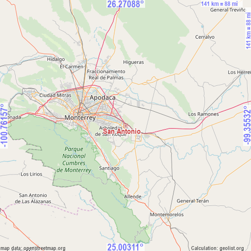
San Antonio GPS coordinates[2]
25° 38' 19.248" North, 100° 3' 30.384" West
| Map corner | latitude | longitude |
|---|---|---|
| Upper-left | 26.27088°, | -100.76157° |
| Center: | 25.63868°, | -100.05844° |
| Lower-right: | 25.00311°, | -99.35532° |
| Map W x H: | 141×141 km | = 87.6×87.6mi |
| max Lat: | 32.7° ⇑6.7% North |
| San Antonio: | 25.63868° |
| min Lat: | ⇓93.3% South 14.53588° |
| min Long | San Antonio | max Long |
| -117.105° | -100.05844° | -86.73105° |
| W 35.3%⇐ | ⇒64.7% E |
Elevation
Elevation of San Antonio is 374 m = 1227 ft, and this is 879.7 m = 2886 ft below average elevation for this country.
| Max E: |
3497 m = 11473 ft | 70.9% |
| Avg. | 1253.7 m = 4113 ft | |
| San Antonio | 374 m = 1227 ft | |
Min E: |
-1 m = -3 ft | 29.1% |
See also: Mexico elevation on elevation.city.
Geographical zone
San Antonio is located in North temperate zone (between Tropic of Cancer and the Arctic Circle). Distance of this Northern Tropic circle is 244.8 km =152.1 mi to South.| Distance of | km | miles | from San Antonio |
|---|---|---|---|
| North Pole | 7156.3 | 4446.7 | to North |
| Arctic Circle | 4550.4 | 2827.5 | to North |
| Tropic Cancer | 244.8 | 152.1 | to South |
| Equator | 2850.8 | 1771.4 | to South |


Nearby cities:
15 places around San Antonio: (largest is in red/bold)
• Bosques de San Pedro
12.8 km =8 mi,  251°
251°
• Cadereyta
9.7 km =6 mi,  129°
129°
• Cadereyta Jiménez
7.9 km =4.9 mi, 134°
• Centro Habitacional Burócratas de Guadalupe
9.5 km =5.9 mi,  268°
268°
• Ciudad Benito Juárez
3.9 km =2.4 mi,  284°
284°
• Dieciséis de Septiembre
10.6 km =6.6 mi,  240°
240°
• Dulces Nombres
10.3 km =6.4 mi,  345°
345°
• Héctor Caballero
6.8 km =4.2 mi, 267°
• Jardines de la Silla (Jardines)
13 km =8.1 mi, 265°
• Loma la Paz
11.1 km =6.9 mi,  316°
316°
• Lomas de San Martín
13.5 km =8.4 mi,  333°
333°
• Los Olmos
13.3 km =8.3 mi, 322°
• Monte Kristal
10 km =6.2 mi,  261°
261°
• Valle de Juárez
10 km =6.2 mi, 269°
• Valle de Vaquerías
8.9 km =5.5 mi, 265°
Sources, notices
• [Note1] Compared only with cities in Mexico existing in our database
• [Src1] Map data: © OpenStreetMap contributors (CC-BY-SA)
• [Src2] Other city data from geonames.org with taken over terms of usage.
• [Src3] Geographical zone / Annual Mean Temperature by Robert A. Rohde @ Wikipedia
