Quila geodata
Quila (Sinaloa) is a populated place; located in Mexico in America/Mazatlan (GMT-7) time zone. With population of 5,793 people, there are 1602 cities with bigger population in this country. Compared to other cities in Mexico, 90.7% of cities are located further ↓South; 94.6% of cities are located further →East and 85.1% of cities have higher elevation than Quila. Note1


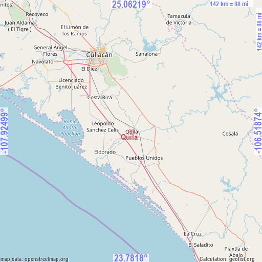
Quila GPS coordinates[2]
24° 25' 25.032" North, 107° 13' 18.696" West
| Map corner | latitude | longitude |
|---|---|---|
| Upper-left | 25.06219°, | -107.92499° |
| Center: | 24.42362°, | -107.22186° |
| Lower-right: | 23.7818°, | -106.51874° |
| Map W x H: | 142.4×142.4 km | = 88.5×88.5mi |
| max Lat: | 32.7° ⇑9.3% North |
| Quila: | 24.42362° |
| min Lat: | ⇓90.7% South 14.53588° |
| min Long | Quila | max Long |
| -117.105° | -107.22186° | -86.73105° |
| W 5.4%⇐ | ⇒94.6% E |
Elevation
Elevation of Quila is 43 m = 141 ft, and this is 1210.7 m = 3972 ft below average elevation for this country.
| Max E: |
3497 m = 11473 ft | 85.1% |
| Avg. | 1253.7 m = 4113 ft | |
| Quila | 43 m = 141 ft | |
Min E: |
-1 m = -3 ft | 14.9% |
See also: Mexico elevation on elevation.city.
Geographical zone
Quila is located in North temperate zone (between Tropic of Cancer and the Arctic Circle). Distance of this Northern Tropic circle is 109.7 km =68.2 mi to South.| Distance of | km | miles | from Quila |
|---|---|---|---|
| North Pole | 7291.4 | 4530.7 | to North |
| Arctic Circle | 4685.5 | 2911.4 | to North |
| Tropic Cancer | 109.7 | 68.2 | to South |
| Equator | 2715.7 | 1687.5 | to South |


Nearby cities:
15 places around Quila: (largest is in red/bold)
• Camalote
9.5 km =5.9 mi,  237°
237°
• Ejido Tierra y Libertad Número Dos
12.2 km =7.6 mi,  310°
310°
• El Huinacaxtle
8.4 km =5.2 mi, 238°
• Guadalupe Victoria
14.7 km =9.1 mi,  199°
199°
• La Cruz de Eldorado (Cruz de Navito)
13.6 km =8.5 mi,  232°
232°
• La Loma (La Loma de Quila)
4.8 km =3 mi,  185°
185°
• Las Piedritas
14.7 km =9.1 mi,  265°
265°
• Las Tres Gotas de Agua
10.8 km =6.7 mi, 268°
• Miguel Valdez Quintero (El Corazón)
12.5 km =7.8 mi, 308°
• Oso Viejo
5.8 km =3.6 mi,  117°
117°
• Portaceli
12 km =7.5 mi, 225°
• Salado
11.3 km =7 mi,  34°
34°
• San Diego
12 km =7.5 mi,  247°
247°
• Tabalá
12.9 km =8 mi,  80°
80°
• Valle Escondido
11.2 km =7 mi,  342°
342°
Sources, notices
• [Note1] Compared only with cities in Mexico existing in our database
• [Src1] Map data: © OpenStreetMap contributors (CC-BY-SA)
• [Src2] Other city data from geonames.org with taken over terms of usage.
• [Src3] Geographical zone / Annual Mean Temperature by Robert A. Rohde @ Wikipedia
