Ortiz geodata
Ortiz (Sonora) is a populated place; located in Mexico in America/Hermosillo (GMT-7) time zone. With population of 1,112 people, there are 7813 cities with bigger population in this country. Compared to other cities in Mexico, 97.6% of cities are located further ↓South; 98.5% of cities are located further →East and 79.2% of cities have higher elevation than Ortiz. Note1


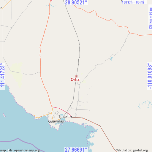
Ortiz GPS coordinates[2]
28° 17' 16.296" North, 110° 42' 50.76" West
| Map corner | latitude | longitude |
|---|---|---|
| Upper-left | 28.90521°, | -111.41723° |
| Center: | 28.28786°, | -110.7141° |
| Lower-right: | 27.66691°, | -110.01098° |
| Map W x H: | 137.7×137.7 km | = 85.6×85.6mi |
| max Lat: | 32.7° ⇑2.4% North |
| Ortiz: | 28.28786° |
| min Lat: | ⇓97.6% South 14.53588° |
| min Long | Ortiz | max Long |
| -117.105° | -110.7141° | -86.73105° |
| W 1.5%⇐ | ⇒98.5% E |
Elevation
Elevation of Ortiz is 108 m = 354 ft, and this is 1145.7 m = 3759 ft below average elevation for this country.
| Max E: |
3497 m = 11473 ft | 79.2% |
| Avg. | 1253.7 m = 4113 ft | |
| Ortiz | 108 m = 354 ft | |
Min E: |
-1 m = -3 ft | 20.8% |
See also: Mexico elevation on elevation.city.
Geographical zone
Ortiz is located in North temperate zone (between Tropic of Cancer and the Arctic Circle). Distance of this Northern Tropic circle is 539.4 km =335.2 mi to South.| Distance of | km | miles | from Ortiz |
|---|---|---|---|
| North Pole | 6861.7 | 4263.7 | to North |
| Arctic Circle | 4255.9 | 2644.5 | to North |
| Tropic Cancer | 539.4 | 335.2 | to South |
| Equator | 3145.3 | 1954.4 | to South |


Nearby cities:
15 places around Ortiz: (largest is in red/bold)
• Antonio Rosales
25.2 km =15.7 mi,  157°
157°
• Cruz de Piedra
37.6 km =23.4 mi,  174°
174°
• Empalme
37.6 km =23.4 mi,  195°
195°
• Francisco Márquez
18.8 km =11.7 mi,  140°
140°
• Guásimas (De Belem)
46.6 km =29 mi, 163°
• Heroica Guaymas
44.8 km =27.8 mi, 203°
• José María Morelos y Pavón
21.3 km =13.2 mi, 173°
• La Palma
26.4 km =16.4 mi,  177°
177°
• Maytorena
23.8 km =14.8 mi,  187°
187°
• Mi Patria es Primero
26.6 km =16.5 mi, 172°
• San Carlos
48.9 km =30.4 mi,  221°
221°
• San Fernando de Guaymas
35.1 km =21.8 mi, 179°
• San José de Guaymas
37.3 km =23.2 mi,  205°
205°
• Santa María de Guaymas
16.3 km =10.1 mi, 172°
• Ursulo Galván
23.3 km =14.5 mi, 173°
Sources, notices
• [Note1] Compared only with cities in Mexico existing in our database
• [Src1] Map data: © OpenStreetMap contributors (CC-BY-SA)
• [Src2] Other city data from geonames.org with taken over terms of usage.
• [Src3] Geographical zone / Annual Mean Temperature by Robert A. Rohde @ Wikipedia
