Oran geodata
Oran (Zacatecas) is a populated place; located in Mexico in America/Mexico_City (GMT-6) time zone. With population of 545 people, there are 15598 cities with bigger population in this country. Compared to other cities in Mexico, 89.9% of cities are located further ↓South; 85.4% of cities are located further →East and 64.5% of cities have lower elevation than Oran. Note1


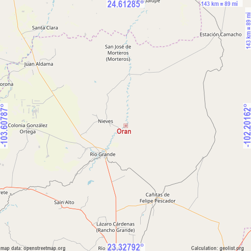
Oran GPS coordinates[2]
23° 58' 19.164" North, 102° 54' 17.064" West
| Map corner | latitude | longitude |
|---|---|---|
| Upper-left | 24.61285°, | -103.60787° |
| Center: | 23.97199°, | -102.90474° |
| Lower-right: | 23.32792°, | -102.20162° |
| Map W x H: | 142.9×142.9 km | = 88.8×88.8mi |
| max Lat: | 32.7° ⇑10.1% North |
| Oran: | 23.97199° |
| min Lat: | ⇓89.9% South 14.53588° |
| min Long | Oran | max Long |
| -117.105° | -102.90474° | -86.73105° |
| W 14.6%⇐ | ⇒85.4% E |
Elevation
Elevation of Oran is 1813 m = 5948 ft, and this is 559.3 m = 1835 ft above average elevation for this country.
| Max E: |
3497 m = 11473 ft | 35.5% |
| Oran | 1813 m 5948 ft | |
| Avg. | 1253.7 m = 4113 ft | |
Min E: |
-1 m = -3 ft | 64.5% |
See also: Mexico elevation on elevation.city.
Geographical zone
Oran is located in North temperate zone (between Tropic of Cancer and the Arctic Circle). Distance of this Northern Tropic circle is 59.5 km =37 mi to South.| Distance of | km | miles | from Oran |
|---|---|---|---|
| North Pole | 7341.6 | 4561.9 | to North |
| Arctic Circle | 4735.7 | 2942.6 | to North |
| Tropic Cancer | 59.5 | 37 | to South |
| Equator | 2665.4 | 1656.2 | to South |


Nearby cities:
15 places around Oran: (largest is in red/bold)
• Cieneguilla (Noria y Cieneguilla)
20.7 km =12.9 mi,  289°
289°
• Francisco I. Madero
6.8 km =4.2 mi,  227°
227°
• Ignacio López Rayón (Los Delgado)
24.1 km =15 mi,  224°
224°
• Independencia San Martín (San Martín)
20.8 km =12.9 mi,  298°
298°
• La Estanzuela
22.7 km =14.1 mi,  260°
260°
• La Florida
25.5 km =15.8 mi, 223°
• Las Piedras
24.8 km =15.4 mi, 220°
• Loreto
17.3 km =10.7 mi, 218°
• Los Condes
23.1 km =14.4 mi, 230°
• Los Ramírez
19.3 km =12 mi, 223°
• Luis Moya
16.9 km =10.5 mi,  2°
2°
• Nieves
12 km =7.5 mi,  282°
282°
• Río Grande
20.6 km =12.8 mi, 218°
• Santa Rita
3.3 km =2.1 mi,  200°
200°
• Tierra Blanca
23.8 km =14.8 mi, 227°
Sources, notices
• [Note1] Compared only with cities in Mexico existing in our database
• [Src1] Map data: © OpenStreetMap contributors (CC-BY-SA)
• [Src2] Other city data from geonames.org with taken over terms of usage.
• [Src3] Geographical zone / Annual Mean Temperature by Robert A. Rohde @ Wikipedia
