Mandujano Atepehuacán geodata
Mandujano Atepehuacán (Guanajuato) is a populated place; located in Mexico in America/Mexico_City (GMT-6) time zone. With population of 650 people, there are 13331 cities with bigger population in this country. Compared to other cities in Mexico, 66.4% of cities are located further ↓South; 70.2% of cities are located further →East and 70.9% of cities have lower elevation than Mandujano Atepehuacán. Note1
Current local time in Mandujano Atepehuacán:
08:04 AM, WednesdayDifference from your time zone: hours


Mandujano Atepehuacán GPS coordinates[2]
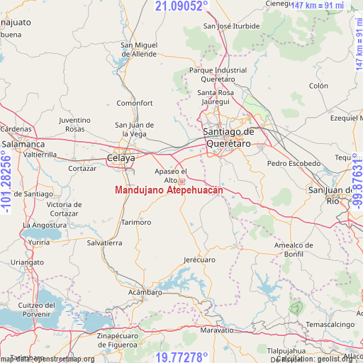
20° 25' 59.016" North, 100° 34' 45.948" West
| Map corner | latitude | longitude |
|---|---|---|
| Upper-left | 21.09052°, | -101.28256° |
| Center: | 20.43306°, | -100.57943° |
| Lower-right: | 19.77278°, | -99.87631° |
| Map W x H: | 146.5×146.5 km | = 91×91mi |
| max Lat: | 32.7° ⇑33.6% North |
| Mandujano Atepehuacán: | 20.43306° |
| min Lat: | ⇓66.4% South 14.53588° |
| min Long | Mandujano Atepe | max Long |
| -117.105° | -100.57943° | -86.73105° |
| W 29.8%⇐ | ⇒70.2% E |
Elevation
Elevation of Mandujano Atepehuacán is 1943 m = 6375 ft, and this is 689.3 m = 2261 ft above average elevation for this country.
| Max E: |
3497 m = 11473 ft | 29.1% |
| Mandujano Atepehuacán | 1943 m 6375 ft | |
| Avg. | 1253.7 m = 4113 ft | |
Min E: |
-1 m = -3 ft | 70.9% |
See also: Mexico elevation on elevation.city.
Geographical zone
Mandujano Atepehuacán is located in North Torrid zone (between Equator and Tropic of Cancer). Distance of this Northern Tropic circle is 334 km =207.5 mi to North.| Distance of | km | miles | from Mandujano Atepehuacán |
|---|---|---|---|
| North Pole | 7735.1 | 4806.4 | to North |
| Arctic Circle | 5129.2 | 3187.1 | to North |
| Tropic Cancer | 334 | 207.5 | to North |
| Equator | 2271.9 | 1411.7 | to South |


Nearby cities:
15 places around Mandujano Atepehuacán: (largest is in red/bold)
• Aguaje de Espejo
3.5 km =2.2 mi,  95°
95°
• Apaseo el Alto
5.1 km =3.2 mi,  302°
302°
• Barajas
4 km =2.5 mi,  235°
235°
• El Espejo
2.8 km =1.7 mi,  71°
71°
• El Pocito (El Pocito de la Virgen)
5.9 km =3.7 mi,  233°
233°
• El Sabino
6.1 km =3.8 mi,  349°
349°
• El Salto de Espejo
7.9 km =4.9 mi,  75°
75°
• La Luisiada
2 km =1.2 mi,  247°
247°
• Ojo de Agua de Espejo
4.9 km =3 mi,  51°
51°
• Ojo de Agua de la Trinidad
7.1 km =4.4 mi, 231°
• San Bartolomé Aguas Calientes
7.7 km =4.8 mi,  24°
24°
• San Isidro de Gamboa
6.9 km =4.3 mi,  127°
127°
• San Vicente
5.4 km =3.4 mi,  43°
43°
• Santa Cruz de Gamboa
8.2 km =5.1 mi, 126°
• Talayote
5.7 km =3.5 mi,  262°
262°
Sources, notices
• [Note1] Compared only with cities in Mexico existing in our database
• [Src1] Map data: © OpenStreetMap contributors (CC-BY-SA)
• [Src2] Other city data from geonames.org with taken over terms of usage.
• [Src3] Geographical zone / Annual Mean Temperature by Robert A. Rohde @ Wikipedia
