Apaseo el Alto geodata
Apaseo el Alto (Guanajuato) is a seat of a second-order administrative division; located in Mexico in America/Mexico_City (GMT-6) time zone. With population of 27,991 people, there are 357 cities with bigger population in this country. Compared to other cities in Mexico, 66.9% of cities are located further ↓South; 70.5% of cities are located further →East and 66.6% of cities have lower elevation than Apaseo el Alto. Note1


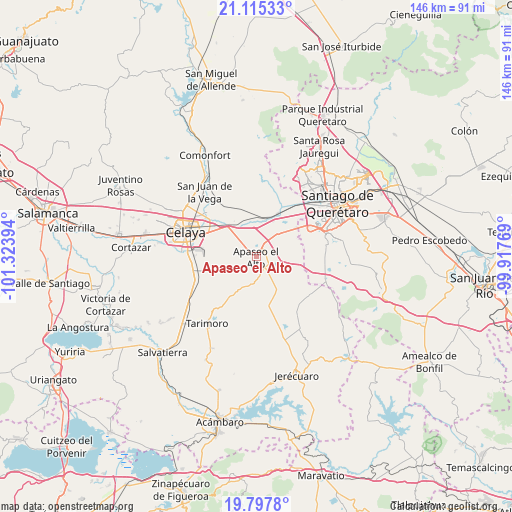
Apaseo el Alto GPS coordinates[2]
20° 27' 28.728" North, 100° 37' 14.916" West
| Map corner | latitude | longitude |
|---|---|---|
| Upper-left | 21.11533°, | -101.32394° |
| Center: | 20.45798°, | -100.62081° |
| Lower-right: | 19.7978°, | -99.91769° |
| Map W x H: | 146.5×146.5 km | = 91×91mi |
| max Lat: | 32.7° ⇑33.1% North |
| Apaseo el Alto: | 20.45798° |
| min Lat: | ⇓66.9% South 14.53588° |
| min Long | Apaseo el Alto | max Long |
| -117.105° | -100.62081° | -86.73105° |
| W 29.5%⇐ | ⇒70.5% E |
Elevation
Elevation of Apaseo el Alto is 1862 m = 6109 ft, and this is 608.3 m = 1996 ft above average elevation for this country.
| Max E: |
3497 m = 11473 ft | 33.4% |
| Apaseo el Alto | 1862 m 6109 ft | |
| Avg. | 1253.7 m = 4113 ft | |
Min E: |
-1 m = -3 ft | 66.6% |
See also: Mexico elevation on elevation.city.
Geographical zone
Apaseo el Alto is located in North Torrid zone (between Equator and Tropic of Cancer). Distance of this Northern Tropic circle is 331.2 km =205.8 mi to North.| Distance of | km | miles | from Apaseo el Alto |
|---|---|---|---|
| North Pole | 7732.3 | 4804.6 | to North |
| Arctic Circle | 5126.5 | 3185.5 | to North |
| Tropic Cancer | 331.2 | 205.8 | to North |
| Equator | 2274.7 | 1413.4 | to South |


Nearby cities:
15 places around Apaseo el Alto: (largest is in red/bold)
• Barajas
5.1 km =3.2 mi,  168°
168°
• Congregación de la Cruz
7 km =4.3 mi,  270°
270°
• El Espejo
7.2 km =4.5 mi,  105°
105°
• El Pocito (El Pocito de la Virgen)
6.3 km =3.9 mi,  183°
183°
• El Sabino
4.5 km =2.8 mi,  44°
44°
• La Luisiada
4.3 km =2.7 mi,  144°
144°
• La Purísima
8.3 km =5.2 mi,  319°
319°
• Mandujano Atepehuacán
5.1 km =3.2 mi,  122°
122°
• Ojo de Agua de Espejo
8.2 km =5.1 mi,  88°
88°
• Ojo de Agua de la Trinidad
7.3 km =4.5 mi,  189°
189°
• San Cristóbal
5.1 km =3.2 mi,  6°
6°
• San José de Agua Azul
4.8 km =3 mi,  311°
311°
• San Pedro Tenango
5.7 km =3.5 mi,  347°
347°
• San Vicente
8.1 km =5 mi,  82°
82°
• Talayote
3.7 km =2.3 mi,  200°
200°
Sources, notices
• [Note1] Compared only with cities in Mexico existing in our database
• [Src1] Map data: © OpenStreetMap contributors (CC-BY-SA)
• [Src2] Other city data from geonames.org with taken over terms of usage.
• [Src3] Geographical zone / Annual Mean Temperature by Robert A. Rohde @ Wikipedia
