Loma de Guamúchil geodata
Loma de Guamúchil (Sonora) is a populated place; located in Mexico in America/Hermosillo (GMT-7) time zone. With population of 1,135 people, there are 7645 cities with bigger population in this country. Compared to other cities in Mexico, 97% of cities are located further ↓South; 98.1% of cities are located further →East and 85.3% of cities have higher elevation than Loma de Guamúchil. Note1


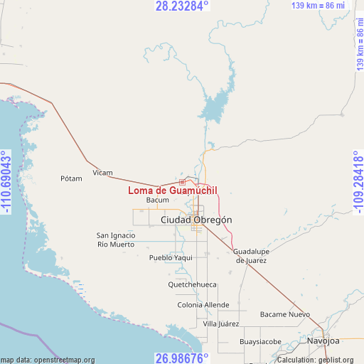
Loma de Guamúchil GPS coordinates[2]
27° 36' 41.652" North, 109° 59' 14.28" West
| Map corner | latitude | longitude |
|---|---|---|
| Upper-left | 28.23284°, | -110.69043° |
| Center: | 27.61157°, | -109.9873° |
| Lower-right: | 26.98676°, | -109.28418° |
| Map W x H: | 138.6×138.6 km | = 86.1×86.1mi |
| max Lat: | 32.7° ⇑3% North |
| Loma de Guamúchil: | 27.61157° |
| min Lat: | ⇓97% South 14.53588° |
| min Long | Loma de Guamúc | max Long |
| -117.105° | -109.9873° | -86.73105° |
| W 1.9%⇐ | ⇒98.1% E |
Elevation
Elevation of Loma de Guamúchil is 42 m = 138 ft, and this is 1211.7 m = 3975 ft below average elevation for this country.
| Max E: |
3497 m = 11473 ft | 85.3% |
| Avg. | 1253.7 m = 4113 ft | |
| Loma de Guamúchil | 42 m = 138 ft | |
Min E: |
-1 m = -3 ft | 14.7% |
See also: Mexico elevation on elevation.city.
Geographical zone
Loma de Guamúchil is located in North temperate zone (between Tropic of Cancer and the Arctic Circle). Distance of this Northern Tropic circle is 464.2 km =288.4 mi to South.| Distance of | km | miles | from Loma de Guamúchil |
|---|---|---|---|
| North Pole | 6936.9 | 4310.4 | to North |
| Arctic Circle | 4331.1 | 2691.2 | to North |
| Tropic Cancer | 464.2 | 288.4 | to South |
| Equator | 3070.1 | 1907.7 | to South |


Nearby cities:
15 places around Loma de Guamúchil: (largest is in red/bold)
• Bataconcica
15.4 km =9.6 mi,  247°
247°
• Bácum
11.6 km =7.2 mi,  234°
234°
• Ciudad Obregón
14.7 km =9.1 mi,  161°
161°
• Cocorit
4.9 km =3 mi,  145°
145°
• Ejido Tepeyac (Campo Dos)
14.8 km =9.2 mi,  191°
191°
• Esperanza
6.7 km =4.2 mi,  122°
122°
• Estación Corral
2.8 km =1.7 mi,  47°
47°
• Loma de Bácum
10.1 km =6.3 mi, 254°
• Los Hornos
14 km =8.7 mi,  36°
36°
• Mora Villalobos
13 km =8.1 mi,  211°
211°
• Providencia
11.1 km =6.9 mi,  181°
181°
• San José de Bacum
18.8 km =11.7 mi, 234°
• Santa Teresa
7.6 km =4.7 mi, 205°
• Vicente Guerrero
8.3 km =5.2 mi,  172°
172°
• Zona de Granjas (Granjas Mica)
15.7 km =9.8 mi,  128°
128°
Sources, notices
• [Note1] Compared only with cities in Mexico existing in our database
• [Src1] Map data: © OpenStreetMap contributors (CC-BY-SA)
• [Src2] Other city data from geonames.org with taken over terms of usage.
• [Src3] Geographical zone / Annual Mean Temperature by Robert A. Rohde @ Wikipedia
