Providencia geodata
Providencia (Sonora) is a populated place; located in Mexico in America/Hermosillo (GMT-7) time zone. With population of 4,501 people, there are 2044 cities with bigger population in this country. Compared to other cities in Mexico, 96.9% of cities are located further ↓South; 98.1% of cities are located further →East and 88.6% of cities have higher elevation than Providencia. Note1


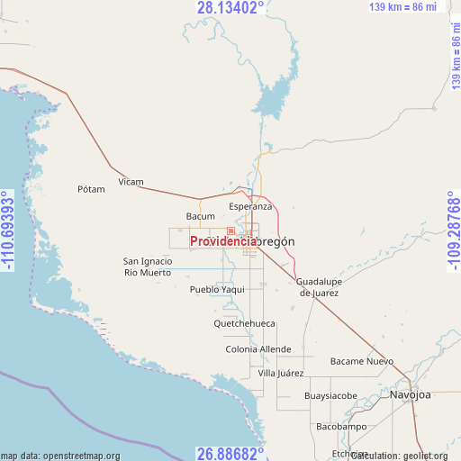
Providencia GPS coordinates[2]
27° 30' 43.884" North, 109° 59' 26.88" West
| Map corner | latitude | longitude |
|---|---|---|
| Upper-left | 28.13402°, | -110.69393° |
| Center: | 27.51219°, | -109.9908° |
| Lower-right: | 26.88682°, | -109.28768° |
| Map W x H: | 138.7×138.7 km | = 86.2×86.2mi |
| max Lat: | 32.7° ⇑3.1% North |
| Providencia: | 27.51219° |
| min Lat: | ⇓96.9% South 14.53588° |
| min Long | Providencia | max Long |
| -117.105° | -109.9908° | -86.73105° |
| W 1.9%⇐ | ⇒98.1% E |
Elevation
Elevation of Providencia is 28 m = 92 ft, and this is 1225.7 m = 4021 ft below average elevation for this country.
| Max E: |
3497 m = 11473 ft | 88.6% |
| Avg. | 1253.7 m = 4113 ft | |
| Providencia | 28 m = 92 ft | |
Min E: |
-1 m = -3 ft | 11.4% |
See also: Mexico elevation on elevation.city.
Geographical zone
Providencia is located in North temperate zone (between Tropic of Cancer and the Arctic Circle). Distance of this Northern Tropic circle is 453.1 km =281.5 mi to South.| Distance of | km | miles | from Providencia |
|---|---|---|---|
| North Pole | 6948 | 4317.3 | to North |
| Arctic Circle | 4342.1 | 2698.1 | to North |
| Tropic Cancer | 453.1 | 281.5 | to South |
| Equator | 3059.1 | 1900.8 | to South |


Nearby cities:
15 places around Providencia: (largest is in red/bold)
• Bácum
10.1 km =6.3 mi,  295°
295°
• Campo Sesenta
12.8 km =8 mi,  237°
237°
• Ciudad Obregón
5.7 km =3.5 mi,  120°
120°
• Cocorit
7.7 km =4.8 mi,  24°
24°
• Cuauhtémoc (Campo Cinco)
9.1 km =5.7 mi,  196°
196°
• Ejido Tepeyac (Campo Dos)
4.3 km =2.7 mi,  216°
216°
• Esperanza
9.6 km =6 mi,  38°
38°
• Estación Corral
13.2 km =8.2 mi,  10°
10°
• Francisco Javier Mina
12.9 km =8 mi, 244°
• Loma de Bácum
12.5 km =7.8 mi,  311°
311°
• Loma de Guamúchil
11.1 km =6.9 mi,  1°
1°
• Mora Villalobos
6.4 km =4 mi,  269°
269°
• Santa Teresa
5.1 km =3.2 mi,  325°
325°
• Vicente Guerrero
3.2 km =2 mi,  25°
25°
• Zona de Granjas (Granjas Mica)
12.6 km =7.8 mi,  84°
84°
Sources, notices
• [Note1] Compared only with cities in Mexico existing in our database
• [Src1] Map data: © OpenStreetMap contributors (CC-BY-SA)
• [Src2] Other city data from geonames.org with taken over terms of usage.
• [Src3] Geographical zone / Annual Mean Temperature by Robert A. Rohde @ Wikipedia
