La Regina geodata
La Regina (Chihuahua) is a populated place; located in Mexico in America/Chihuahua (GMT-6) time zone. With population of 739 people, there are 11825 cities with bigger population in this country. Compared to other cities in Mexico, 97.7% of cities are located further ↓South; 93.2% of cities are located further →East and 57.6% of cities have higher elevation than La Regina. Note1


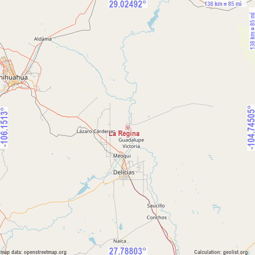
La Regina GPS coordinates[2]
28° 24' 29.808" North, 105° 26' 53.412" West
| Map corner | latitude | longitude |
|---|---|---|
| Upper-left | 29.02492°, | -106.1513° |
| Center: | 28.40828°, | -105.44817° |
| Lower-right: | 27.78803°, | -104.74505° |
| Map W x H: | 137.5×137.5 km | = 85.4×85.4mi |
| max Lat: | 32.7° ⇑2.3% North |
| La Regina: | 28.40828° |
| min Lat: | ⇓97.7% South 14.53588° |
| min Long | La Regina | max Long |
| -117.105° | -105.44817° | -86.73105° |
| W 6.8%⇐ | ⇒93.2% E |
Elevation
Elevation of La Regina is 1112 m = 3648 ft, and this is 141.7 m = 465 ft below average elevation for this country.
| Max E: |
3497 m = 11473 ft | 57.6% |
| Avg. | 1253.7 m = 4113 ft | |
| La Regina | 1112 m = 3648 ft | |
Min E: |
-1 m = -3 ft | 42.4% |
See also: Mexico elevation on elevation.city.
Geographical zone
La Regina is located in North temperate zone (between Tropic of Cancer and the Arctic Circle). Distance of this Northern Tropic circle is 552.8 km =343.5 mi to South.| Distance of | km | miles | from La Regina |
|---|---|---|---|
| North Pole | 6848.4 | 4255.4 | to North |
| Arctic Circle | 4242.5 | 2636.2 | to North |
| Tropic Cancer | 552.8 | 343.5 | to South |
| Equator | 3158.7 | 1962.7 | to South |


Nearby cities:
15 places around La Regina: (largest is in red/bold)
• Ampliación Colonia Lázaro Cárdenas
16.7 km =10.4 mi,  260°
260°
• Barranco Blanco
16.3 km =10.1 mi,  281°
281°
• Colonia Esperanza
4.4 km =2.7 mi,  351°
351°
• Colonia Felipe Ángeles
6.7 km =4.2 mi,  247°
247°
• Colonia San José
2.9 km =1.8 mi,  164°
164°
• El Torreón
9.7 km =6 mi, 159°
• Estación Consuelo
16.7 km =10.4 mi,  239°
239°
• Guadalupe Victoria
8.6 km =5.3 mi,  166°
166°
• Jiménez
9.6 km =6 mi,  150°
150°
• Julimes
2.7 km =1.7 mi,  49°
49°
• Las Puentes
12.4 km =7.7 mi,  179°
179°
• Los García
6.2 km =3.9 mi, 161°
• Lázaro Cárdenas
17.3 km =10.7 mi, 263°
• Meoqui
15.5 km =9.6 mi,  191°
191°
• Salón de Actos (Ampliación Cuarenta y Siete)
14 km =8.7 mi,  315°
315°
Sources, notices
• [Note1] Compared only with cities in Mexico existing in our database
• [Src1] Map data: © OpenStreetMap contributors (CC-BY-SA)
• [Src2] Other city data from geonames.org with taken over terms of usage.
• [Src3] Geographical zone / Annual Mean Temperature by Robert A. Rohde @ Wikipedia
