Jiménez geodata
Jiménez (Chihuahua) is a populated place; located in Mexico in America/Chihuahua (GMT-6) time zone. With population of 31,054 people, there are 324 cities with bigger population in this country. Compared to other cities in Mexico, 97.6% of cities are located further ↓South; 93% of cities are located further →East and 56.9% of cities have higher elevation than Jiménez. Note1


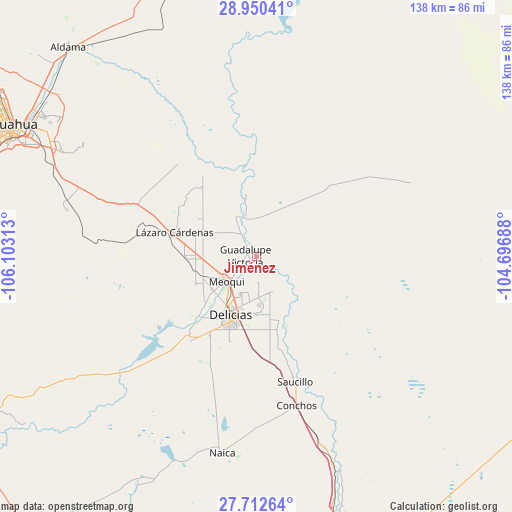
Jiménez GPS coordinates[2]
28° 19' 59.988" North, 105° 24' 0" West
| Map corner | latitude | longitude |
|---|---|---|
| Upper-left | 28.95041°, | -106.10313° |
| Center: | 28.33333°, | -105.4° |
| Lower-right: | 27.71264°, | -104.69688° |
| Map W x H: | 137.6×137.6 km | = 85.5×85.5mi |
| max Lat: | 32.7° ⇑2.4% North |
| Jiménez: | 28.33333° |
| min Lat: | ⇓97.6% South 14.53588° |
| min Long | Jiménez | max Long |
| -117.105° | -105.4° | -86.73105° |
| W 7%⇐ | ⇒93% E |
Elevation
Elevation of Jiménez is 1125 m = 3691 ft, and this is 128.7 m = 422 ft below average elevation for this country.
| Max E: |
3497 m = 11473 ft | 56.9% |
| Avg. | 1253.7 m = 4113 ft | |
| Jiménez | 1125 m = 3691 ft | |
Min E: |
-1 m = -3 ft | 43.1% |
See also: Mexico elevation on elevation.city.
Geographical zone
Jiménez is located in North temperate zone (between Tropic of Cancer and the Arctic Circle). Distance of this Northern Tropic circle is 544.5 km =338.3 mi to South.| Distance of | km | miles | from Jiménez |
|---|---|---|---|
| North Pole | 6856.7 | 4260.6 | to North |
| Arctic Circle | 4250.8 | 2641.3 | to North |
| Tropic Cancer | 544.5 | 338.3 | to South |
| Equator | 3150.4 | 1957.6 | to South |


Nearby cities:
15 places around Jiménez: (largest is in red/bold)
• Colonia Abraham González (La Quemada)
14.1 km =8.8 mi,  182°
182°
• Colonia Esperanza
13.7 km =8.5 mi,  337°
337°
• Colonia Felipe Ángeles
12.4 km =7.7 mi,  297°
297°
• Colonia Revolución
11 km =6.8 mi,  202°
202°
• Colonia San José
6.8 km =4.2 mi,  324°
324°
• Colonia Terrazas
12.4 km =7.7 mi,  211°
211°
• Colonia Vicente Guerrero
15.3 km =9.5 mi,  190°
190°
• Congregación Ortíz
14.6 km =9.1 mi,  232°
232°
• El Torreón
1.6 km =1 mi,  239°
239°
• Guadalupe Victoria
2.7 km =1.7 mi,  269°
269°
• Julimes
10.4 km =6.5 mi,  345°
345°
• La Regina
9.6 km =6 mi,  330°
330°
• Las Puentes
6.2 km =3.9 mi, 228°
• Los García
3.7 km =2.3 mi,  311°
311°
• Meoqui
10.4 km =6.5 mi, 229°
Sources, notices
• [Note1] Compared only with cities in Mexico existing in our database
• [Src1] Map data: © OpenStreetMap contributors (CC-BY-SA)
• [Src2] Other city data from geonames.org with taken over terms of usage.
• [Src3] Geographical zone / Annual Mean Temperature by Robert A. Rohde @ Wikipedia
