Providencia geodata
Providencia (Guanajuato) is a populated place; located in Mexico in America/Mexico_City (GMT-6) time zone. With population of 666 people, there are 13039 cities with bigger population in this country. Compared to other cities in Mexico, 81% of cities are located further ↓South; 71.6% of cities are located further →East and 74.5% of cities have lower elevation than Providencia. Note1


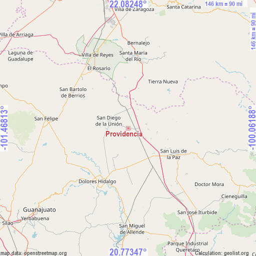
Providencia GPS coordinates[2]
21° 25' 45.984" North, 100° 45' 54" West
| Map corner | latitude | longitude |
|---|---|---|
| Upper-left | 22.08248°, | -101.46813° |
| Center: | 21.42944°, | -100.765° |
| Lower-right: | 20.77347°, | -100.06188° |
| Map W x H: | 145.5×145.6 km | = 90.4×90.5mi |
| max Lat: | 32.7° ⇑19% North |
| Providencia: | 21.42944° |
| min Lat: | ⇓81% South 14.53588° |
| min Long | Providencia | max Long |
| -117.105° | -100.765° | -86.73105° |
| W 28.4%⇐ | ⇒71.6% E |
Elevation
Elevation of Providencia is 2021 m = 6631 ft, and this is 767.3 m = 2517 ft above average elevation for this country.
| Max E: |
3497 m = 11473 ft | 25.5% |
| Providencia | 2021 m 6631 ft | |
| Avg. | 1253.7 m = 4113 ft | |
Min E: |
-1 m = -3 ft | 74.5% |
See also: Mexico elevation on elevation.city.
Geographical zone
Providencia is located in North Torrid zone (between Equator and Tropic of Cancer). Distance of this Northern Tropic circle is 223.2 km =138.7 mi to North.| Distance of | km | miles | from Providencia |
|---|---|---|---|
| North Pole | 7624.3 | 4737.5 | to North |
| Arctic Circle | 5018.4 | 3118.3 | to North |
| Tropic Cancer | 223.2 | 138.7 | to North |
| Equator | 2382.7 | 1480.5 | to South |


Nearby cities:
15 places around Providencia: (largest is in red/bold)
• Adjuntas del Monte
14 km =8.7 mi,  192°
192°
• Catalán del Refugio (Catalanes)
12.1 km =7.5 mi,  166°
166°
• El Colorado
9 km =5.6 mi,  333°
333°
• El Rosalito
14.3 km =8.9 mi,  114°
114°
• Garabatillo
13 km =8.1 mi, 172°
• La California
16.2 km =10.1 mi,  201°
201°
• La Granja
5.6 km =3.5 mi,  74°
74°
• La Sauceda
7.6 km =4.7 mi,  36°
36°
• Parritas
9.8 km =6.1 mi,  351°
351°
• Peñuelas
5.4 km =3.4 mi,  208°
208°
• Pozo Hondo
16.5 km =10.3 mi,  98°
98°
• San Antonio
13.9 km =8.6 mi,  261°
261°
• San Diego de la Unión
12 km =7.5 mi,  290°
290°
• San Juan Pan de Arriba
16.7 km =10.4 mi, 286°
• Vergel de Guadalupe
10.4 km =6.5 mi,  76°
76°
Sources, notices
• [Note1] Compared only with cities in Mexico existing in our database
• [Src1] Map data: © OpenStreetMap contributors (CC-BY-SA)
• [Src2] Other city data from geonames.org with taken over terms of usage.
• [Src3] Geographical zone / Annual Mean Temperature by Robert A. Rohde @ Wikipedia
