Jerécuaro geodata
Jerécuaro (Guanajuato) is a seat of a second-order administrative division; located in Mexico in America/Mexico_City (GMT-6) time zone. With population of 7,748 people, there are 1204 cities with bigger population in this country. Compared to other cities in Mexico, 60.3% of cities are located further ↓South; 69.6% of cities are located further →East and 72% of cities have lower elevation than Jerécuaro. Note1


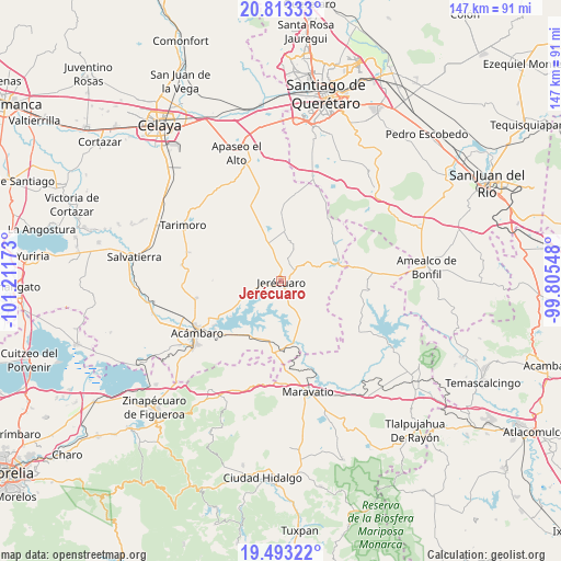
Jerécuaro GPS coordinates[2]
20° 9' 16.812" North, 100° 30' 30.96" West
| Map corner | latitude | longitude |
|---|---|---|
| Upper-left | 20.81333°, | -101.21173° |
| Center: | 20.15467°, | -100.5086° |
| Lower-right: | 19.49322°, | -99.80548° |
| Map W x H: | 146.8×146.8 km | = 91.2×91.2mi |
| max Lat: | 32.7° ⇑39.7% North |
| Jerécuaro: | 20.15467° |
| min Lat: | ⇓60.3% South 14.53588° |
| min Long | Jerécuaro | max Long |
| -117.105° | -100.5086° | -86.73105° |
| W 30.4%⇐ | ⇒69.6% E |
Elevation
Elevation of Jerécuaro is 1967 m = 6453 ft, and this is 713.3 m = 2340 ft above average elevation for this country.
| Max E: |
3497 m = 11473 ft | 28% |
| Jerécuaro | 1967 m 6453 ft | |
| Avg. | 1253.7 m = 4113 ft | |
Min E: |
-1 m = -3 ft | 72% |
See also: Mexico elevation on elevation.city.
Geographical zone
Jerécuaro is located in North Torrid zone (between Equator and Tropic of Cancer). Distance of this Northern Tropic circle is 364.9 km =226.7 mi to North.| Distance of | km | miles | from Jerécuaro |
|---|---|---|---|
| North Pole | 7766.1 | 4825.6 | to North |
| Arctic Circle | 5160.2 | 3206.4 | to North |
| Tropic Cancer | 364.9 | 226.7 | to North |
| Equator | 2241 | 1392.5 | to South |


Nearby cities:
15 places around Jerécuaro: (largest is in red/bold)
• Buenavista
15.7 km =9.8 mi,  182°
182°
• El Fresno
13.3 km =8.3 mi,  7°
7°
• El Terrero
7 km =4.3 mi,  255°
255°
• Estanzuela de Razo
7.1 km =4.4 mi,  196°
196°
• Estanzuela de Romero
3.4 km =2.1 mi, 7°
• La Huerta
12 km =7.5 mi,  67°
67°
• La Purisima del Zapóte
3.8 km =2.4 mi,  238°
238°
• Las Pilas de Puruagua
15.4 km =9.6 mi,  148°
148°
• Ojo de Agua de Mendoza
6.4 km =4 mi,  281°
281°
• Piedras de Lumbre
14.3 km =8.9 mi,  318°
318°
• Puroagua
10.2 km =6.3 mi, 145°
• Sabino Seco
14.4 km =8.9 mi,  170°
170°
• San Pablo
6.3 km =3.9 mi,  333°
333°
• San Pedro de los Agustinos
10.1 km =6.3 mi, 321°
• Santiaguillo
14.9 km =9.3 mi,  250°
250°
Sources, notices
• [Note1] Compared only with cities in Mexico existing in our database
• [Src1] Map data: © OpenStreetMap contributors (CC-BY-SA)
• [Src2] Other city data from geonames.org with taken over terms of usage.
• [Src3] Geographical zone / Annual Mean Temperature by Robert A. Rohde @ Wikipedia
