Gambino geodata
Gambino (Sinaloa) is a populated place; located in Mexico in America/Mazatlan (GMT-7) time zone. With population of 1,151 people, there are 7530 cities with bigger population in this country. Compared to other cities in Mexico, 93.4% of cities are located further ↓South; 96.1% of cities are located further →East and 88.3% of cities have higher elevation than Gambino. Note1


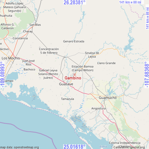
Gambino GPS coordinates[2]
25° 39' 6.048" North, 108° 23' 12.48" West
| Map corner | latitude | longitude |
|---|---|---|
| Upper-left | 26.28381°, | -109.08993° |
| Center: | 25.65168°, | -108.3868° |
| Lower-right: | 25.01618°, | -107.68368° |
| Map W x H: | 140.9×140.9 km | = 87.6×87.6mi |
| max Lat: | 32.7° ⇑6.6% North |
| Gambino: | 25.65168° |
| min Lat: | ⇓93.4% South 14.53588° |
| min Long | Gambino | max Long |
| -117.105° | -108.3868° | -86.73105° |
| W 3.9%⇐ | ⇒96.1% E |
Elevation
Elevation of Gambino is 29 m = 95 ft, and this is 1224.7 m = 4018 ft below average elevation for this country.
| Max E: |
3497 m = 11473 ft | 88.3% |
| Avg. | 1253.7 m = 4113 ft | |
| Gambino | 29 m = 95 ft | |
Min E: |
-1 m = -3 ft | 11.7% |
See also: Mexico elevation on elevation.city.
Geographical zone
Gambino is located in North temperate zone (between Tropic of Cancer and the Arctic Circle). Distance of this Northern Tropic circle is 246.3 km =153 mi to South.| Distance of | km | miles | from Gambino |
|---|---|---|---|
| North Pole | 7154.9 | 4445.8 | to North |
| Arctic Circle | 4549 | 2826.6 | to North |
| Tropic Cancer | 246.3 | 153 | to South |
| Equator | 2852.2 | 1772.3 | to South |


Nearby cities:
15 places around Gambino: (largest is in red/bold)
• Bamoa
7.2 km =4.5 mi,  34°
34°
• Caimanero
7.6 km =4.7 mi,  227°
227°
• Carboneras
6.8 km =4.2 mi,  11°
11°
• Cruz Blanca
3 km =1.9 mi, 32°
• El Cuitabón
5.9 km =3.7 mi, 232°
• El Nio
3.3 km =2.1 mi,  204°
204°
• El Sabino
3.6 km =2.2 mi,  349°
349°
• El Varal (San Sebastián Número Uno)
4 km =2.5 mi,  255°
255°
• Las Juntas de Chamicari
5 km =3.1 mi,  313°
313°
• Las Moras
7.2 km =4.5 mi,  275°
275°
• Las Quemazones
7.6 km =4.7 mi,  299°
299°
• Norotillos
7.3 km =4.5 mi,  90°
90°
• Orba (Infiernito)
4.8 km =3 mi, 29°
• Pueblo Viejo
5.1 km =3.2 mi,  214°
214°
• San Sebastián Número Dos
2.7 km =1.7 mi,  334°
334°
Sources, notices
• [Note1] Compared only with cities in Mexico existing in our database
• [Src1] Map data: © OpenStreetMap contributors (CC-BY-SA)
• [Src2] Other city data from geonames.org with taken over terms of usage.
• [Src3] Geographical zone / Annual Mean Temperature by Robert A. Rohde @ Wikipedia
